blah blah blah
Table Rock
Length: 3.0 miles out-and-backDifficulty (click for info): Moderate
Elevation Gain: 1100 feet
Rating (click for info): 7/10
Elevation: 2510'
Driving Directions:
Trailhead and parking area are on Rt. 26 in Dixville, NH. The parking area is 12 miles east of Rt. 3. It is on the south side of the road and is marked by a sign for Dixville Notch Wayside. The trail begins near an informative sign.
About the Hike:
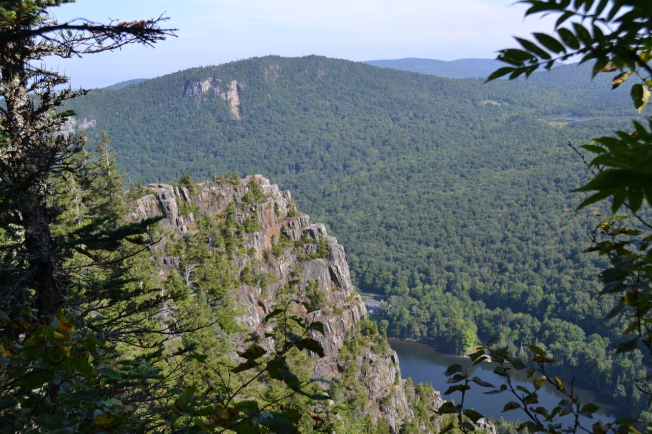
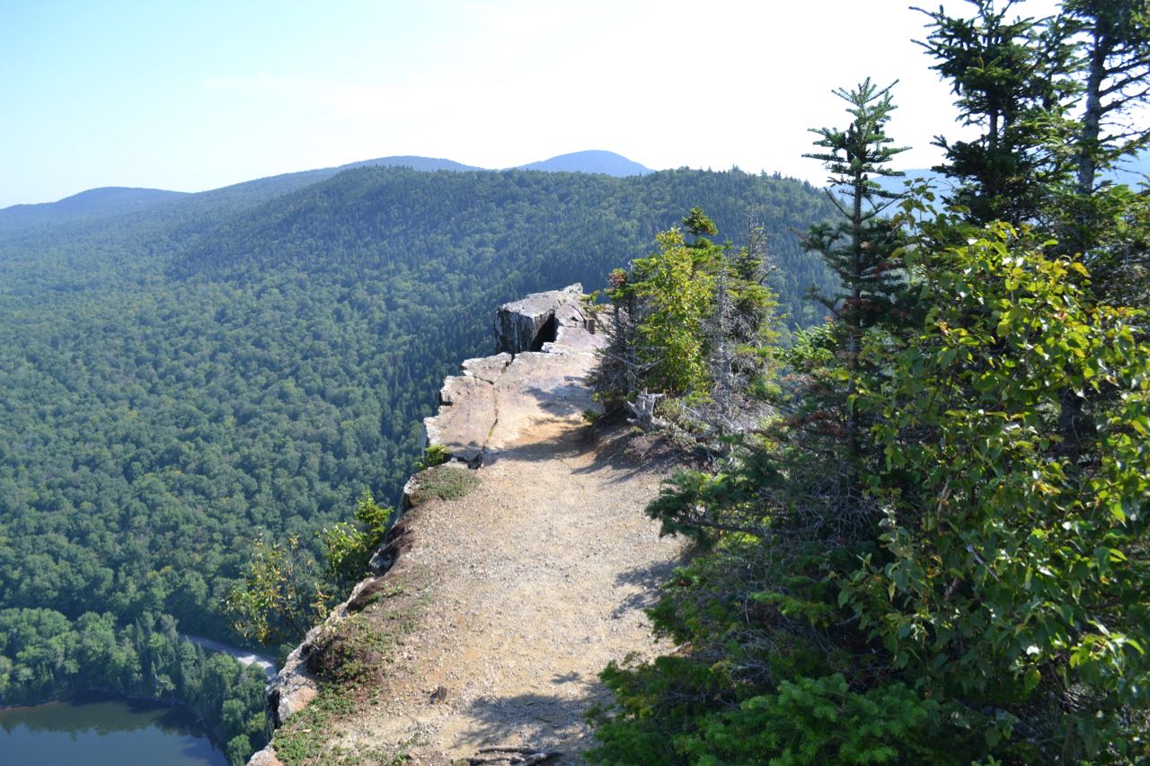
The high rocky pinnacles which rise on the south side of Dixville Notch are like no other place in New Hampshire. It is a rugged and wild area on the side of Mt. Gloriette. The tallest of these crags is known as Table Rock. Full of crevices, never more than six feet wide, and with a 700 foot vertical drop on every side, Table Rock is surely one of the most frightening places in the entire state. Hikers test their courage by attempting to walk out to the very end of the rock, a very difficult feat, as the end is narrow, cracked, and slopes downward. Please be aware that trying to accomplish may be dangerous, and that you should never go beyond the point which you can comfortably and safely reach.
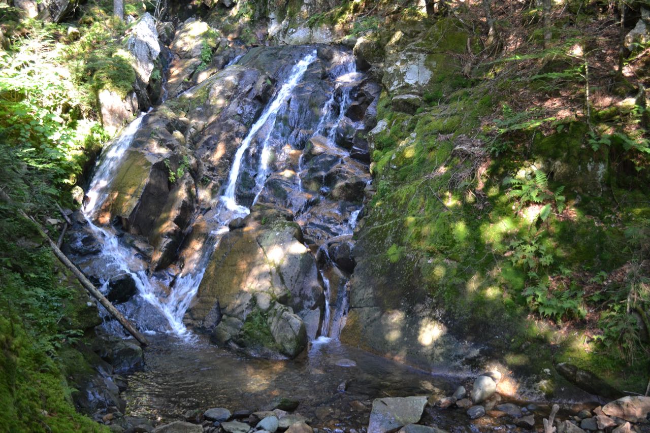
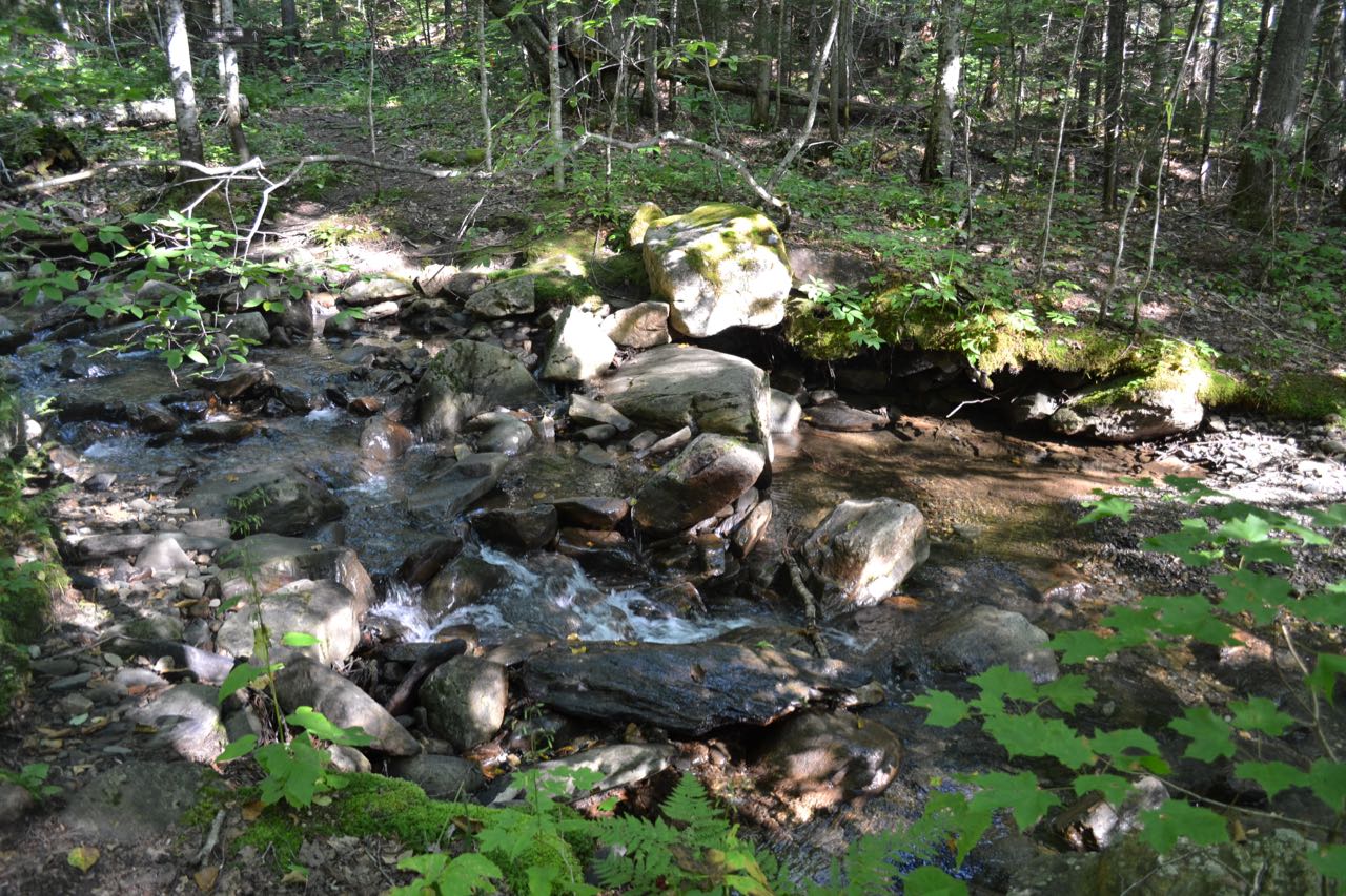
Aside from the hazards of Table Rock, it is also an exiting place with a fine view. There are several trails to it, but the easiest and most scenic is Three Brothers Trail. The hike starts on Huntington Cascades Trail, which begins as a gravel path through a picnic area, but quickly turns to dirt. Crossing a bridge, it soon arrives at Huntington Cascades. For the short walk to this waterfall only, see Huntington Cascades. The lower part of the waterfall is easily visible from the trail. It is a wide, fanning cascade which flows over an angled rock. The upper cascades are much more impressive. They are made up of a series of falls through a very long and deep ravine, walled in with rock. Unfortunately, many tree branches restrict the view of the upper falls. The trail climbs very steeply alongside the cascades before leveling off. It now ascends gradually through the forest before crossing the brook. Here, half a mile from the parking area, the trail becomes Three Brothers Trail. On the other side, the incline increases a little more, but still remains fairly easy. The trail ascends at this grade for 0.8 miles through the forest until reaching a spur trail on the right leading to Middle Brother Outlook. This little-used path is 0.1 miles long and leads to a viewpoint of Table Rock. Again, the trail steepens, now at a fairly tough grade, but it is not this way for very long. After climbing to a high point, where there is a view to Table Rock, it descends for a short distance. The trail passes a deep crevasse in the ground, known as Ice Cave, and soon meets Table Rock Trail, which enters from the left. Bear right here, dropping down steeply over rocks, then bear left just past this as the unmarked Table Rock Trail turns right. The trail then edges out onto the narrow rock ledge.
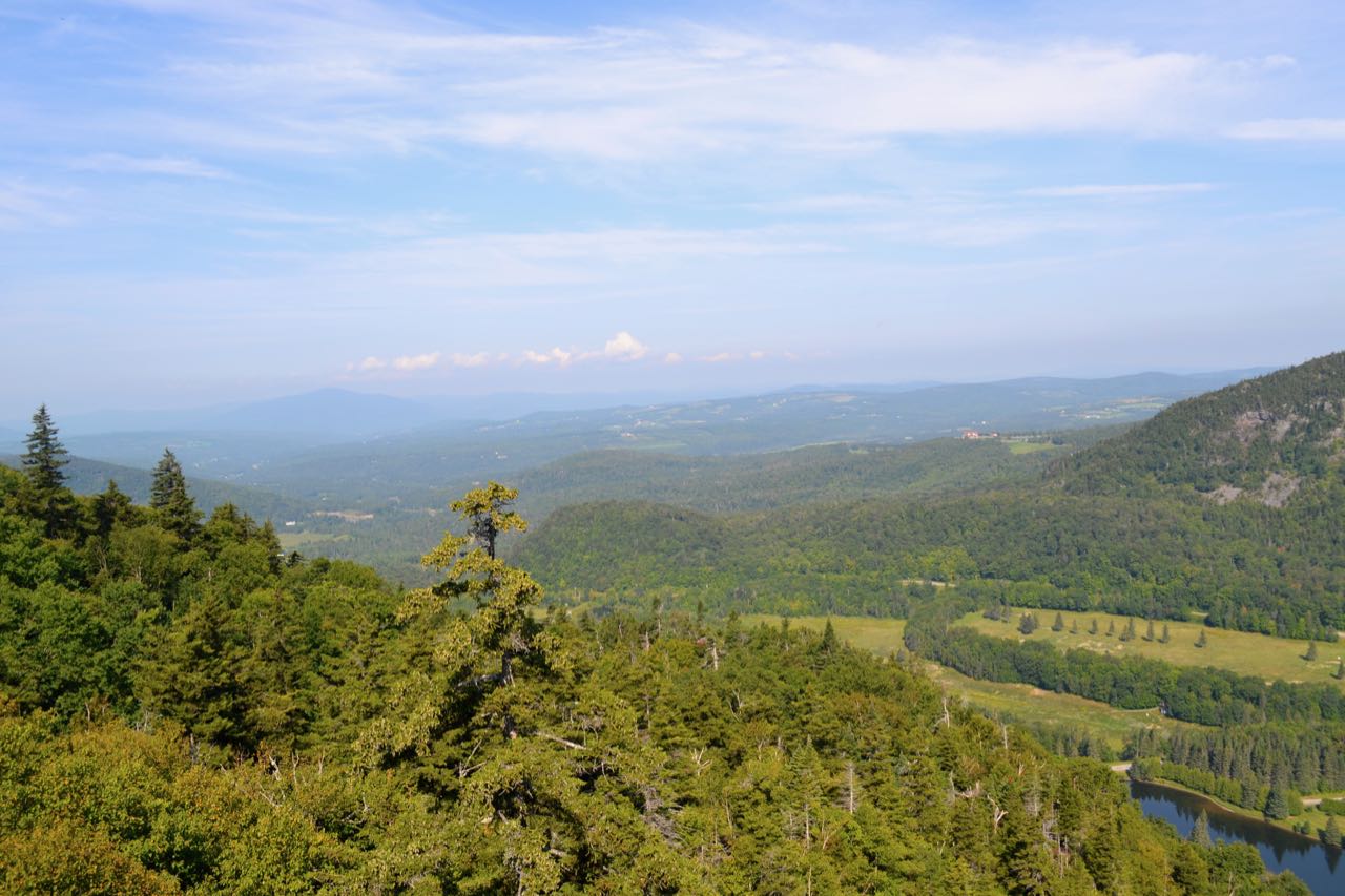
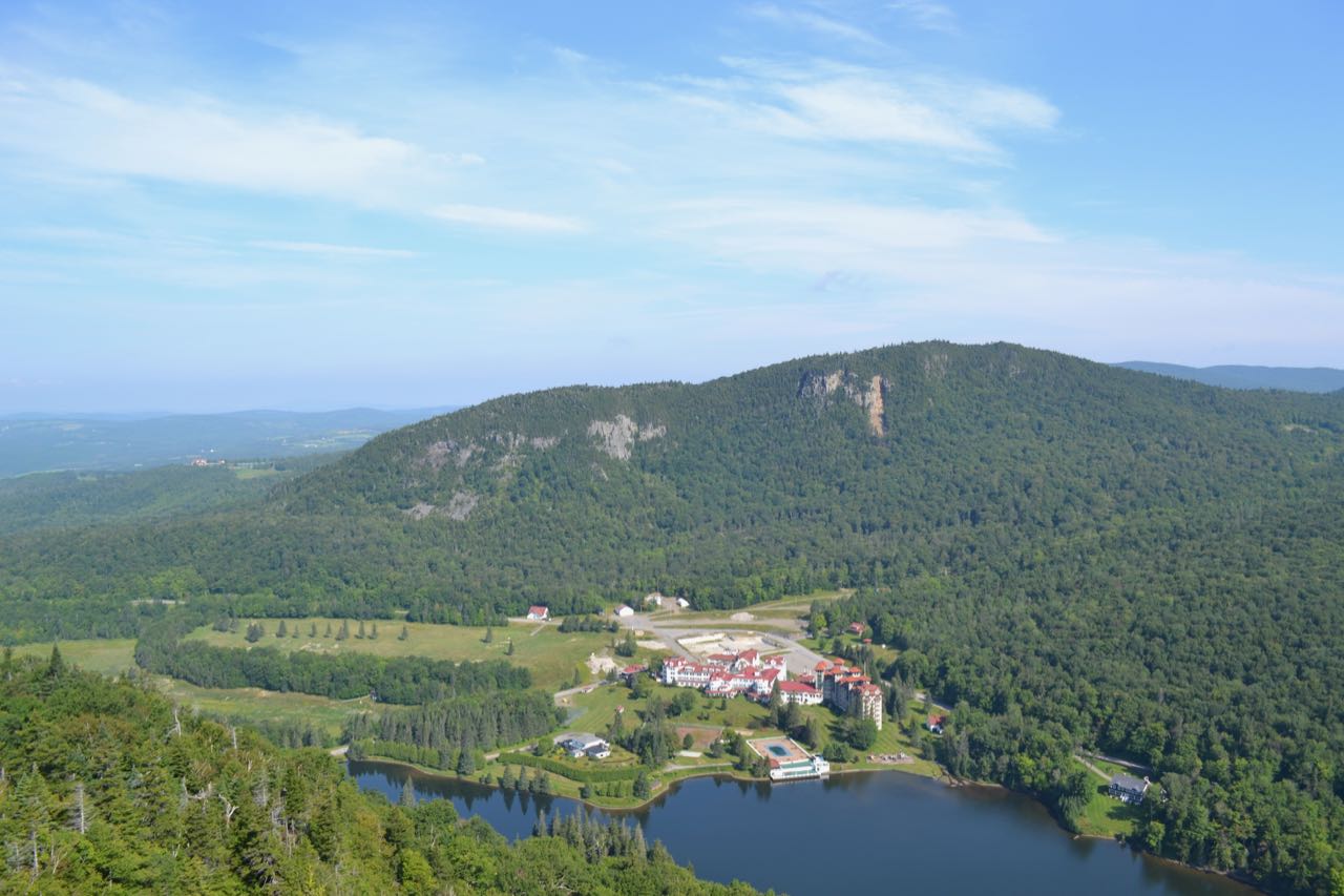
When seen from up close, Table Rock looks nothing like it did from the trail viewpoint. Follow this a short distance down and then back up to the craggy ledges of Table Rock. It is very narrow, less than six feet wide as you move out onto the rock. Near the woods, there are many small trees growing, and the view is limited. Continuing out, the rock rises to a small flat area, where you can see most of the view. This is a good, safe place to enjoy the views if you do not wish to risk walking out further. There are many large cracks in the cliff. Ahead, the rock drops a few feet, narrows more, and the surface turns to dirt. The view is a bit more open here. Beyond this area is the most jagged, narrow section of the rock, which quickly decreases in width. There are very close-up views across the notch in both directions. To the west, looking out the notch, Vermont is visible, with its prominent Monadnock Mountain. Straight ahead and far below is the former Balsams Resort. Next to the Balsams is Lake Gloriette. Above it is small, cliffy Mt. Abeniki. To the north, Table Rock points directly to Sanguinary Mountain, with Cave Mountain peeking above. To the west is Rice Mountain, and further down is Black Mountain. On your side of the notch are more impressive cliffs.
Printable directions page