blah blah blah
Shelburne Moriah Mountain
Length: 11.4 miles out-and-backDifficulty (click for info): Extreme
Elevation Gain: 3100 feet
Rating (click for info): 9/10
Elevation: 3735'
Prominence: 445'
Driving Directions:
Trailhead and parking area are on Rt. 2 in Shelburne, NH. The large parking area is on the south side of the road, 3.5 miles east of Rt. 16 and 5.6 miles west of the Maine border.
About the Hike:
Shelburne Moriah is the northernmost major peak in the Carter Range. Its expansive, ledgy alpine area at the top offers sweeping views similar to Mt. Moriah's. It is most easily reached via the Rattle River Trail, which has easy grades for several miles, but involves a very steep rocky, and sustained climb at the end. The hike ends with an enjoyable meander over the ledges along the ridge.
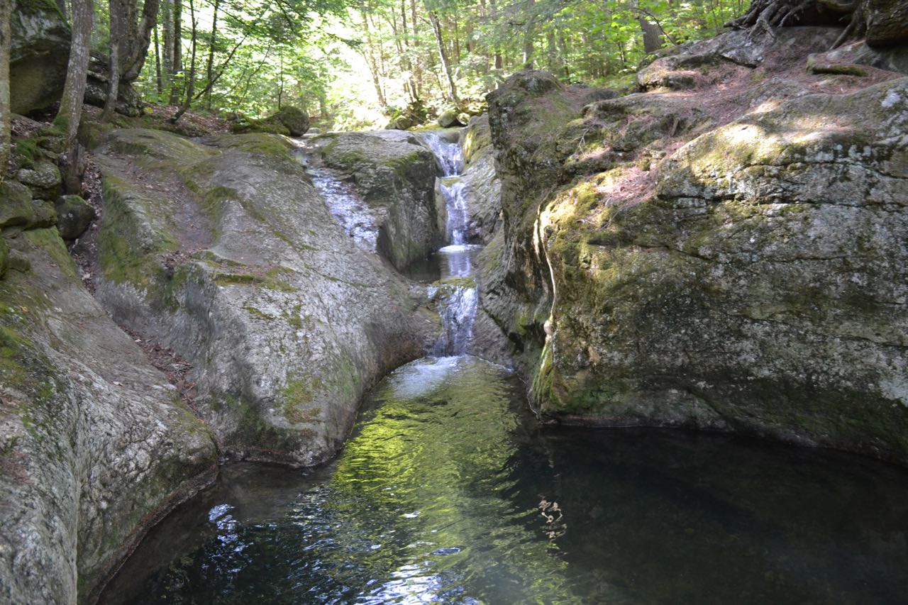
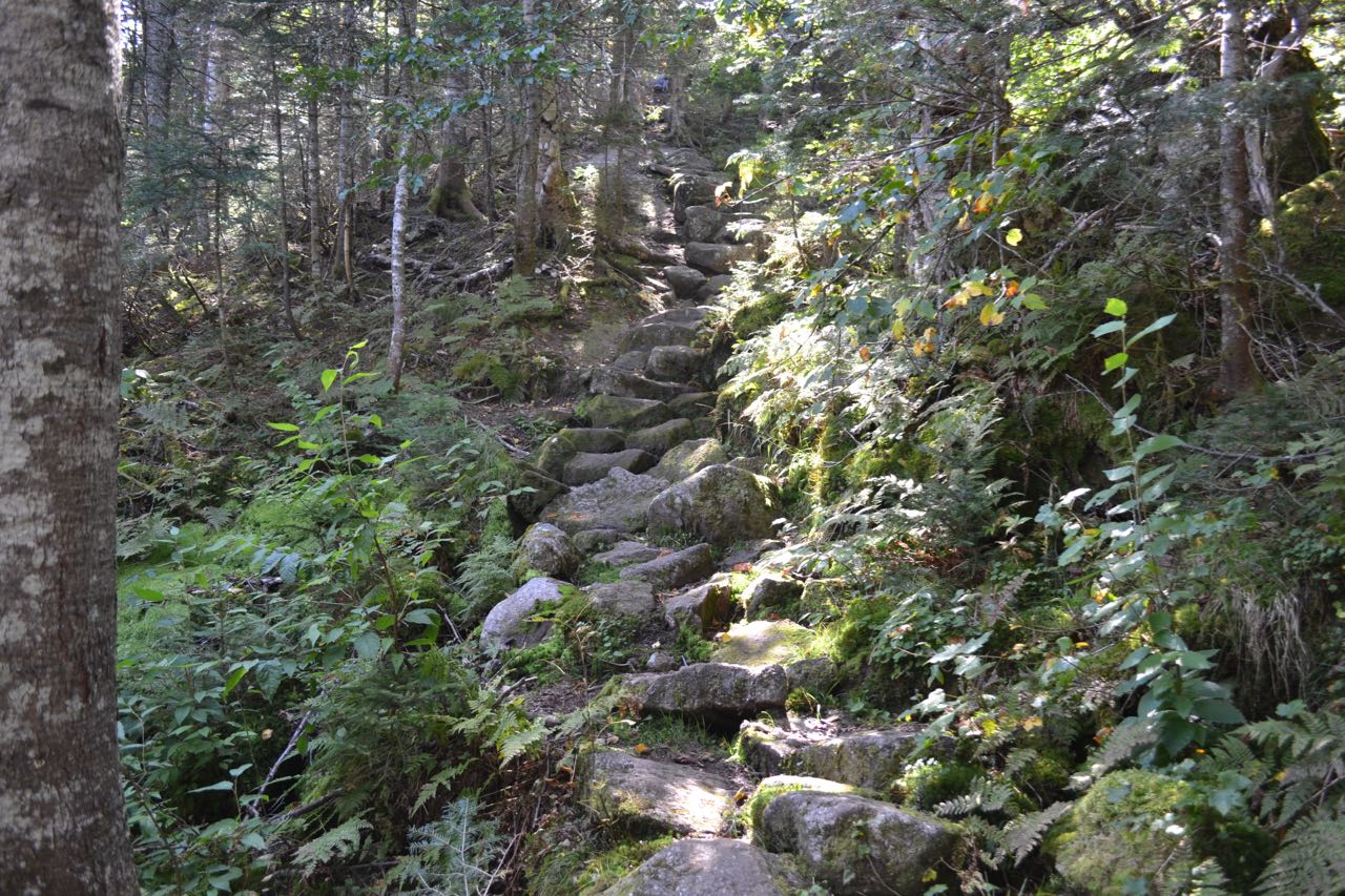
From the parking area, begin hiking on Rattle River Trail. The trail heads out into the forest at easy grades, following Rattle River. In 0.3 miles, the trail joins a snowmobile trail, which comes in from a bridge over the river. The trail ascends gradually, and the snowmobile trail diverges to the left in another 0.3 miles. The trail then crosses a small, ledgy brook and continues climbing. High above the river, it continues one mile to Rattle River Shelter. Directly beside the building, look for an unmarked path on the right. This leads down to a large pool in the river and turns right, following the boundary of a revegetation area down to three small waterslides flowing through a carved rock chute into a deep pool, a worthwhile side trip. Continuing on the main trail, it proceeds at easy grades through the forest near the river, and in just over 0.1 miles, crosses to the other side. The trail continues along the river, passing near a ledgy area with several nice cascades, then recrosses in 0.2 miles. This crossing is much easier, since it is just upstream of where two branches of the river join. The trail ascends moderately for a while, then becomes gradually rougher as it heads across the increasingly steep slope above the river. After 1.2 miles, it descends and crosses one of the uppermost branches of the river, which is very small and can often be dry. Once across, the trail begins to climb much more steeply. It becomes more difficult as it climbs higher, and eventually becomes very rugged. Many stone staircases aid the ascent. The trail follows the river, just out of sight, nearly to its source as it climbs. The forest becomes dark and mossy toward the top, and after a mile of arduous climbing, just before ending, the trail flattens out and enters a bog.
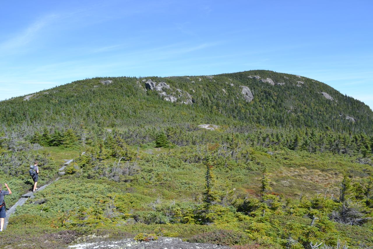
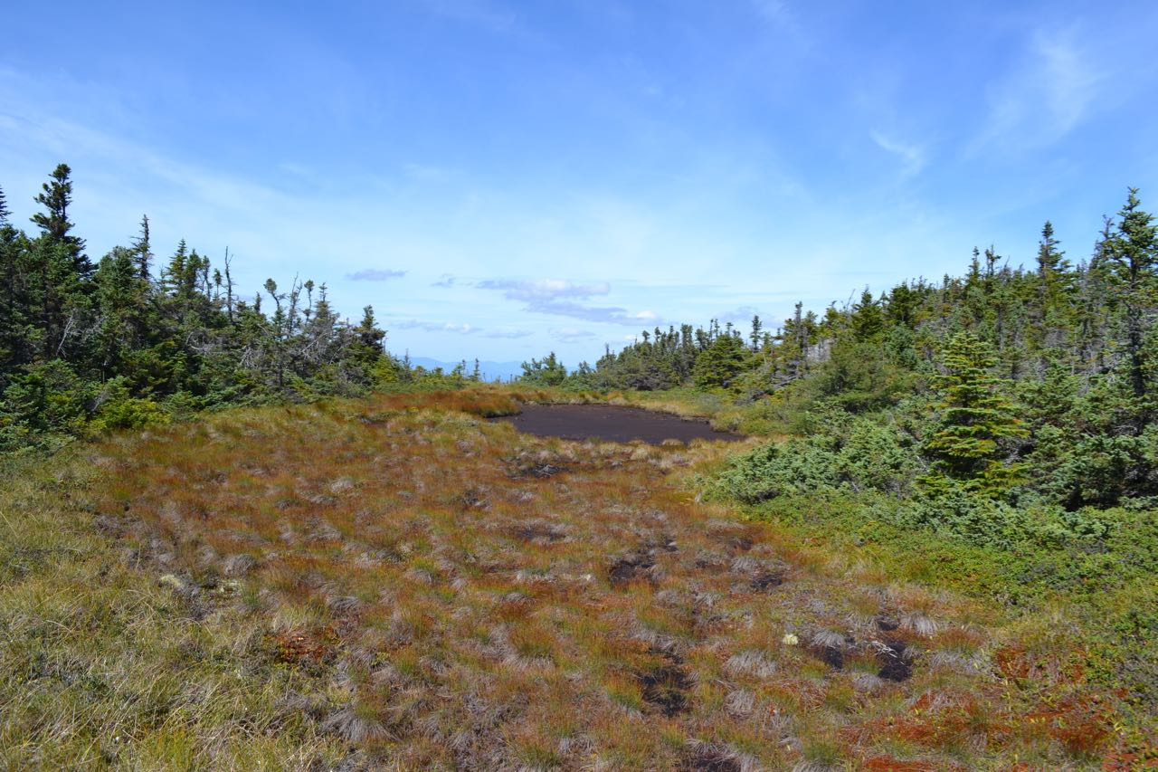
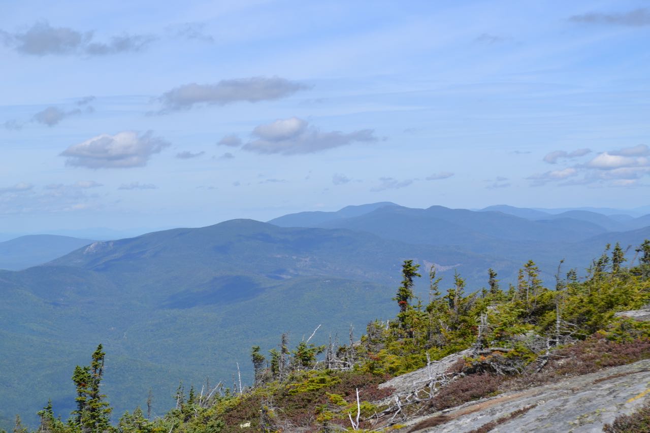
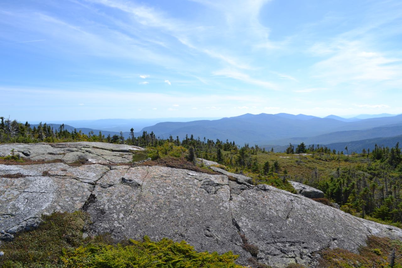
Bog bridges lead to a trail junction in the middle of the wetland. Turn left onto Kenduskeag Trail. The trail proceeds across the ridge top, climbing over several humps and passing through a few muddy spots before climbing up into a slightly open area in 0.3 miles. Two more times, the trail pops up into the open, but quickly drops back down into the woods. Soon, the trail comes out into the first expansive alpine area. Here, you see the first views into the Wild River Wilderness. To the southwest, the Baldface Range rises over the Wild River valley. On the other side, several ridges lead up to the Carter Range, where you see Mt. Moriah and Middle Moriah Mountain. The ledgy summit of Shelburne Moriah, with a sharp drop-off on the east side, looms ahead, over the alpine plateaus. The trail meanders over the ledges, then crosses a large open bog. After 0.8 miles from the junction, the trail dips back into the forest and climbs steeply, with several tricky rock scrambles, to the next open ledge. Here, you can look back to the bog where you were before. As you climb higher, look back as the Presidentials rise over the two Moriah summits. More of the Carter Range appears as well. Views open up toward the Gorham-Berlin area now, and the Crescent, Pliny, and Pilot Ranges beyond. After another short stretch through the forest, the trail crosses another, smaller, but more open alpine bog, then continues climbing over open ledges with constant views. As you crest another small plateau, views open toward the southern Mahoosuc Range and into the distance beyond. Below, you can see the Androscoggin River. One final climb through the forest leads to the best view ledge, just below the summit, where you can enjoy the full panorama, including the northern Mahoosuc Range. The summit is marked with a large cairn; here, Kenduskeag Trail continues to the east, on an obscure, overgrown pathway. A good view toward the Caribou-Speckled Mountain Wilderness and Evans Notch can be found by following this trail 0.2 miles to another alpine bog and view ledge.
Printable directions page