blah blah blah
Mts. Oscar and Rosebrook
Length: 4.2 miles out-and-backDifficulty (click for info): Moderate
Elevation Gain: 1640 (+160 feet on return)
Rating (click for info): 8/10
Elevation: 3004' (Rosebrook) and 2746' (Oscar)
Prominence: 264' (Rosebrook) and 206' (Oscar)
Driving Directions:
Trailhead and parking area are at Bretton Woods Ski Area in Carroll, NH. The entrance to the base area is on the southwest side of Rt. 302, 4.6 miles east of Rt. 3 in Twin Mountain. Park in the regular parking lot for the base lodge. Click here for a Google map.
About the Hike:
Mt. Oscar and Mt. Rosebrook are the two mountains which make up the Bretton Woods Ski Area. The ski area refers to Mt. Oscar as "West Mountain". It is not well-known to hikers, but the summit has extensive open ledges with magnificent views over the Zealand Valley. It's a secluded area just behind the West Mountain express chairlift that feels like it is far from civilization despite being a few feet from the ski trails. Because it overlooks a scenic river valley, it is a prime destination for fall foliage viewing. Mt. Rosebrook doesn't have scenic open ledges, but it is higher than Mt. Oscar, and it does provide a great view of the Presidential Range from the top of the ski slopes. Rosebrook is also notable for having one of New Hampshire's first fire towers. Built by the Mt. Pleasant Hotel Company in 1903, it, along with the lookout on Croydon Peak, was put in service in response to the disastrous fires in the White Mountains at the turn of the century and was later incorporated into the NH Forestry Commision's new network of towers. It is a worthwhile excursion to visit both peaks, but for the hike to Mt. Oscar alone, see Mt. Oscar. It is a great place to escape the crowds, although the hike begins on the Bretton Woods ski slopes, so the base may be crowded even when the summit isn't.
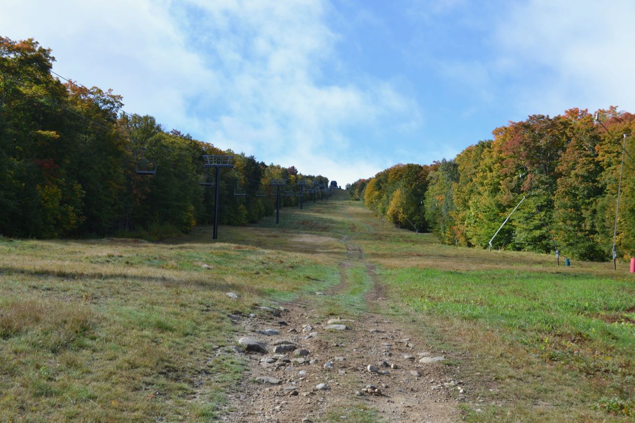
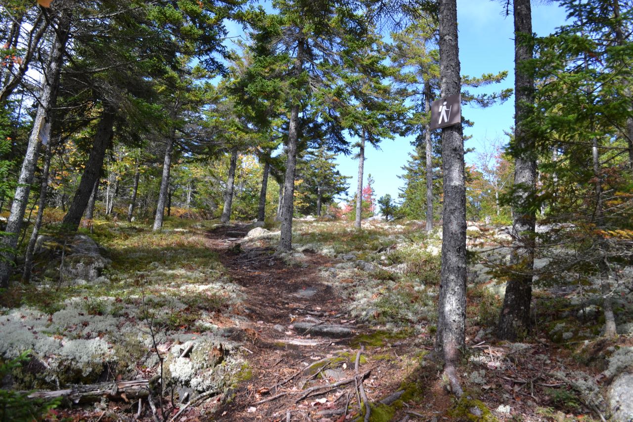
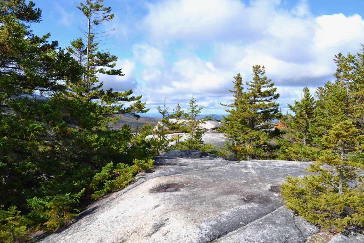
Start your hike at the Bretton Woods base lodge. Walk to the side of the lodge closest to the ski trails and turn right and walk along the base area. Pass by the Bethlehem Express ski lift, join a dirt path, and walk up to the Zephyr ski lift. Begin walking up the ski slopes, following this chairlift along the Rangeview Ski Trail. This is the ski area's designated hiking route (although this could change in the future; consult staff at the lodge for more information). Soon, you will be able to see the top of the chairlift, where you are headed. Although the end is in sight from the beginning, pace yourself because walking directly up this ski trail is grueling and will take longer than you expect. The first views that will open as you climb are of Mt. Waumbek, Mt. Deception, and Mt. Dartmouth. As you climb further up, you will see the Presidential Range as well. The climb to the top of the lift will be about one mile. Just before you reach it, cross a dirt access road and climb up the steepest pitch of the trail. When you arrive at the lift, continue straight and walk toward the woods at the back of the ski trails. Turn right and follow the left edge of the ski trail heading downhill. As you walk, look for a path leading into the woods over snowmaking pipes. Several unmarked paths are available to cut through and lead just a few feet to the main hiking trail on Mt. Oscar. This trail, although not well-used, is well marked with arrows and hiking signs. Turn right on this trail, heading northwest. Descend at an easy grade for 0.15 miles to the low point between Mt. Rosebrook and Mt. Oscar. Around this area, a rock climber's trail comes in from the left. The trail then starts climbing, and in 0.1 miles, emerges in a ski glade. It follows along the edge of the glades for another 0.1 miles, passing through an interesting area where the ground is covered with blueberry bushes and lichens. Shortly after this, the trail comes out onto ledges and passes close to the top of the ski lift on Mt. Oscar. A sign points the way to "West Mountain Summit", which is reached in 200 yards. Head out to the back of the ledges and descend a bit for the best views.
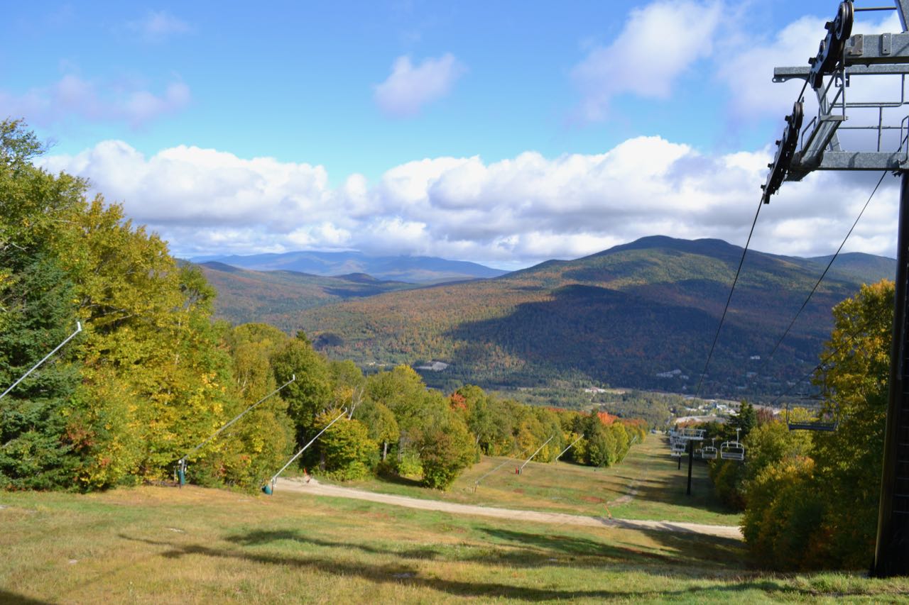
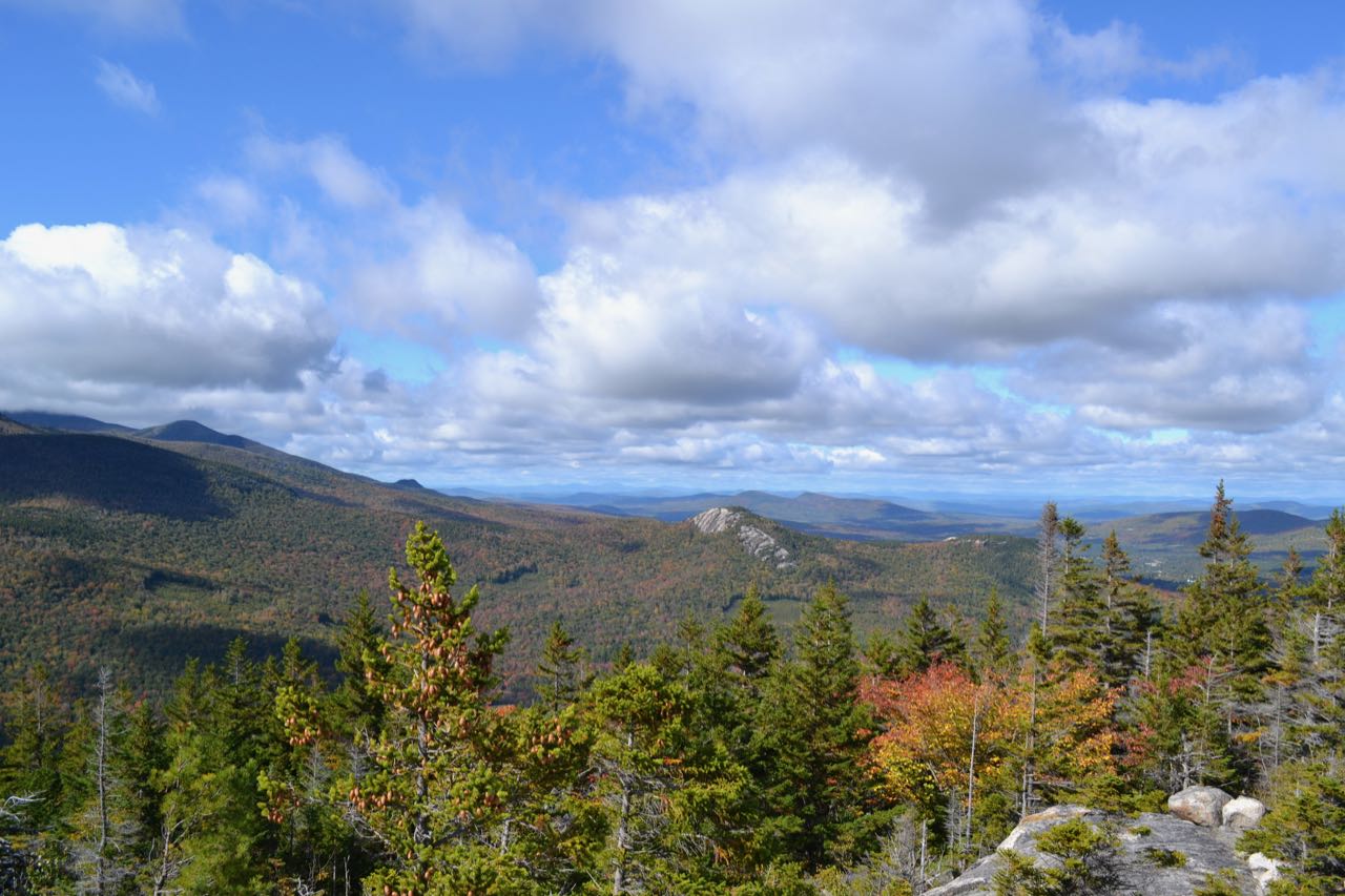
You have a spectacular 180-degree panorama from this area. On your left, the higher peak of Mt. Rosebrook rises. Look closely and you can see the ski lift. Next is Mt. Tom in the Willey Range, further up the Rosebrook ridge. Out across the Zealand Valley, you see the ridge leading down from West Field to Whitewall Mountain, with majestic Mt. Carrigain in the distance between them. Mt. Hancock looms behind the partially-hidden Zealand Notch. On the right side of the notch, you see Zeacliff and Zealand Ridge. Much closer by, the huge mass of Mt. Hale is directly across the Zealand River from you. You have a really good view of the talus slopes on its east shoulder. A bit behind Hale and to the right is North Twin Mountain and the Peak above the Nubble. Much lower to the right is the Nubble itself. Further over, the view extends out a great distance to the Green Mountains in Vermont. In the foreground are the cliffs of Middle Sugarloaf, with Mts. Cleveland and Agassiz behind. You will want to spend time exploring the ledges to take in all the nuances of this unique view. In the autumn, the Zealand Valley bursts with vibrant color. For views in the other direction, you can head out to the top of the ski slopes. From there, you will find more views of Mt. Waumbek and the Dartmouth Range, as you saw on the way up, but now with an open view of Cherry Mountain.
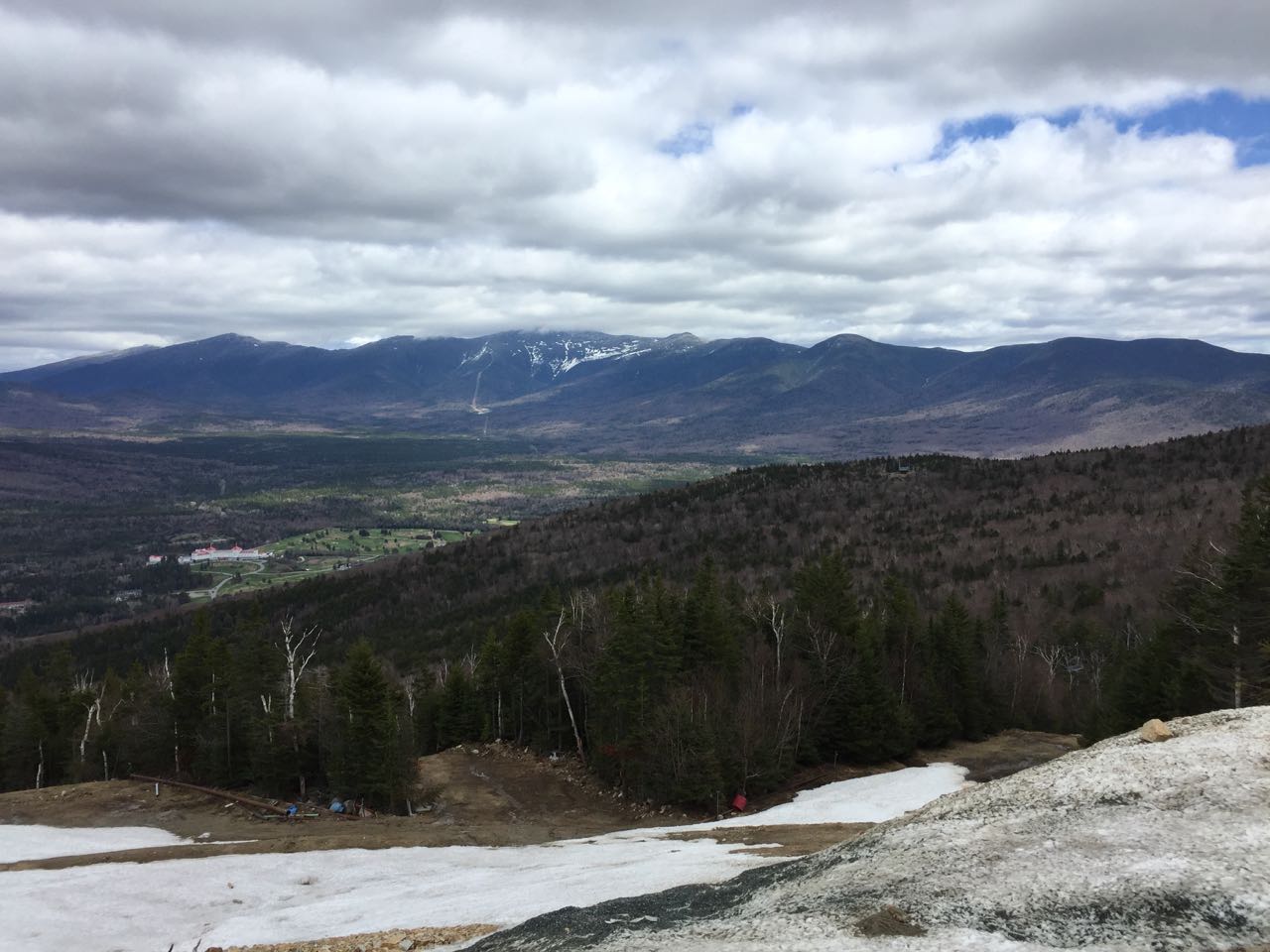
Once you have thoroughly enjoyed the views, you can return the same way you came to the chairlift at the top of the Rangeview Trail. To reach Mt. Rosebrook, walk up the ski trail on the other side. An access road leads up the ski trail, providing a convenient place to walk. You will pass some ski glades on the left, then several trails. After 0.3 miles of steep climbing, you will reach the top of a newly-constructed ski lift, along with a new lodge. Continue to follow the ski trail uphill, and you will climb another 0.2 miles to the summit. You will find the best views around the top of the chairlift. You have a full vista of the Presidential Range, and all of the southern peaks are in clear view. The highest point on the mountain is located behind a ski trail map.
Printable directions page