blah blah blah
Mt. Kearsarge
Length: 2.9 mile loopDifficulty (click for info): Moderate
Elevation Gain: 1100 feet (+10 feet on descent)
Rating (click for info): 7/10
Elevation: 2934'
Prominence: 2108'
Driving Directions:
Trailhead and parking area are at the end of Kearsarge Mountain road in Wilmot, NH. Take Exit 10 off Rt. 89 in Warner and turn right onto North Road. Quickly turn right to stay on North Road. In 0.4 miles, turn left onto Kearsarge Valley Road. Drive 3.0 miles, then turn right onto Kearsarge Mountain Road. Go 1.6 miles up this rather steep and winding road, and bear right into the Winslow State Park entrance (gated in winter). In another 0.9 miles, reach the parking area, right after the gatehouse where a $4 parking fee is charged when the park is operating. Click here for a Google map.
Trail Map
About the Hike:
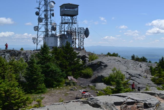
Mt. Kearsarge, one of the most popular hiking destinations in southern NH, has expansive, panoramic views from its wide summit. Most people anywhere near the area have been to one of the two state parks on each side of the mountain. At Rollins State Park, on the southern side, visitors drive the majority of the way up the mountain and hike up either of two very brief trails to the summit. On the northwestern side, starting from the picnic area at Winslow State Park, the hiking option is a bit more interesting with the three-mile loop offered by the Winslow and Barlow Trails. The starting point is still fairly high up the mountain after the steep drive up Kearsarge Mountain Road, but there’s a lot more terrain to explore on this side, including great views as the trails explore the extensive open ledges around the summit and an unusual alpine bog. The Winslow Trail makes a somewhat steep and shorter ascent with plenty of climbing up steep, rocky trail, while the Barlow Trail offers a longer and more gradual route back down. Whichever way you get to the top, the summit of Mt. Kearsarge with its fire tower is one of the most iconic mountain peaks in New Hampshire and it’s a must see.
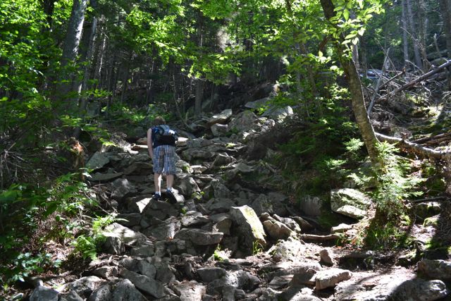
Walk up to the "To All Trails" sign at the top of the parking area and head into the woods toward the kiosk. The two trails split here; fork right onto Winslow Trail. The trail crosses a power line clearing in 0.1 miles, then climbs moderately through the woods with plentiful roots and rocks underfoot. Eventually, the trail steepens and becomes much rougher, climbing to a rock painted with a "1/2" marker in another half mile. At the top of this steep pitch, it levels off and swings around to the left, and after some more climbing up a smooth rock face, reaches the first open ledge in another 0.15 miles. Here there is a directional view to the west, looking toward the distant peaks of Mt. Ascutney and Croydon Peak. The trail eases up beyond this ledge and soon emerges on open rock and winds through small fir trees. Follow blazes and rock cairns carefully as you see the cell tower and fire tower close ahead over the trees. After 0.3 miles, Barlow Trail joins from the left just before the trail comes completely out into the open on the bare rock dome of the summit.
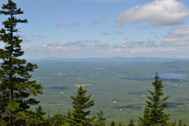
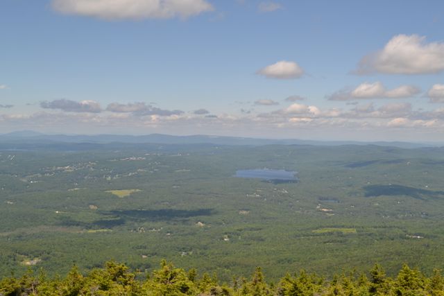
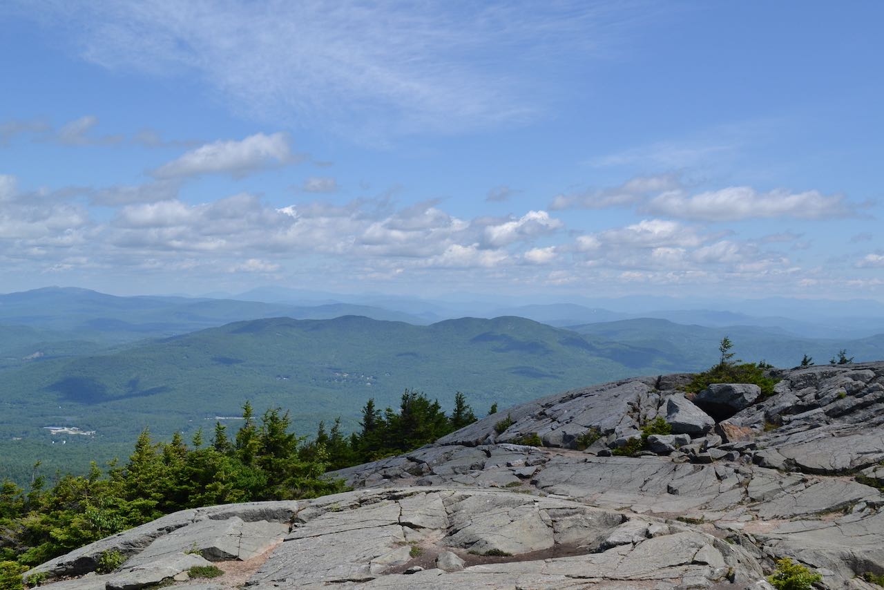
At the highest point is the summit fire tower, while in a sheltered area are a few picnic tables. There is plenty of space to move around on top, which is advantageous, since heavy crowds are common. On a clear day, you can see the White Mountains to the north. In front of the Whites is Ragged Mountain, and to the left are Mt. Cardigan and Smarts Mountain, among others. To the west, you have a good perspective of the lengthy ridgeline of the Green Mountains. To the southwest is Mt. Sunapee and Lake Sunapee. Mt. Monadnock can be spotted in the distance to the south, as can the Wapack Range. To the southeast, the small Uncanoonuc Mountains rise from the flat expanse.
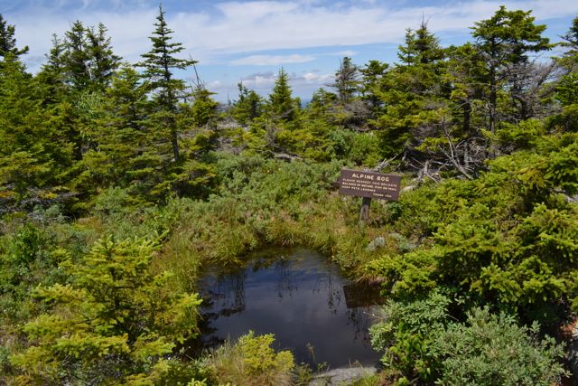
After enjoying the view, you can return on the more gradual Barlow Trail. Head back to the trail junction just before the top and turn right. The Barlow Trail winds through the fir forest on the open rock for about 0.3 miles, passing an alpine bog. Hikers will find excellent viewpoints along the trail where it's much less crowded. After the trail leaves the open ledges, it meanders through the forest for the remaining 1.3 miles, descending at a mostly moderate grade. A sharp left turn marks the halfway point in this section.
Printable directions page