blah blah blah
Mt. Roberts
Length: 5.5 miles out-and-backDifficulty (click for info): Moderate
Elevation Gain: 1350 feet
Rating (click for info): 7/10
Elevation: 2582'
Prominence: 112'
Driving Directions:
Trailhead and parking area are on Ossipee Park Road in Moultonborough, NH. Ossipee Park Road starts on the northeast side of Rt. 171, 0.5 miles east of Rt. 109. Drive about 1.5 miles up Osipee Park Road. Parking is available at a small pull-off on the right with a kiosk just after the gate or along the road past Cones in the Clouds Ice Cream. Click here for a Google map.
About the Hike:
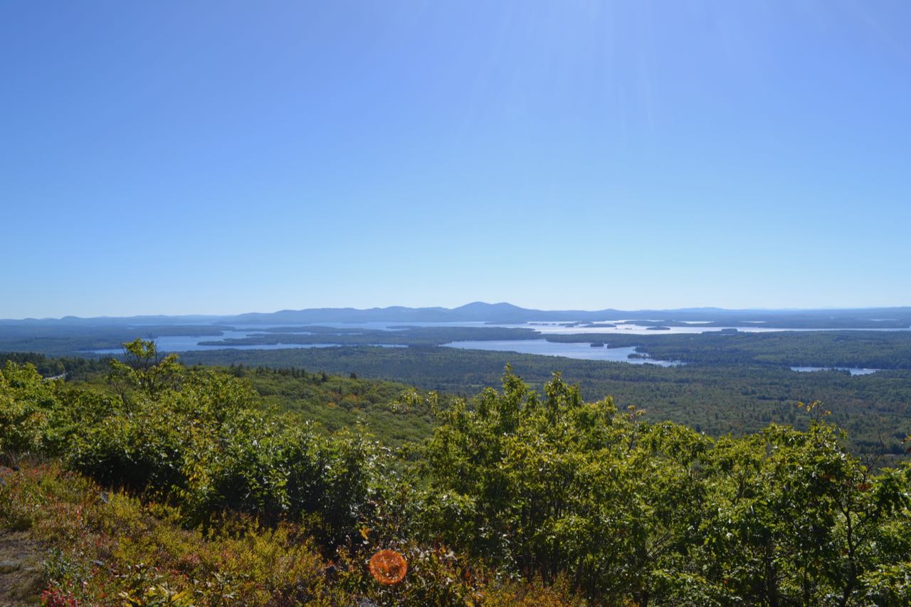
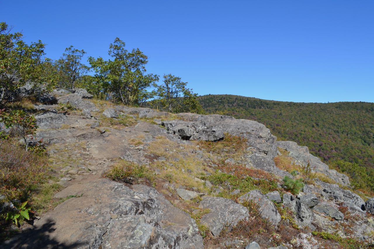
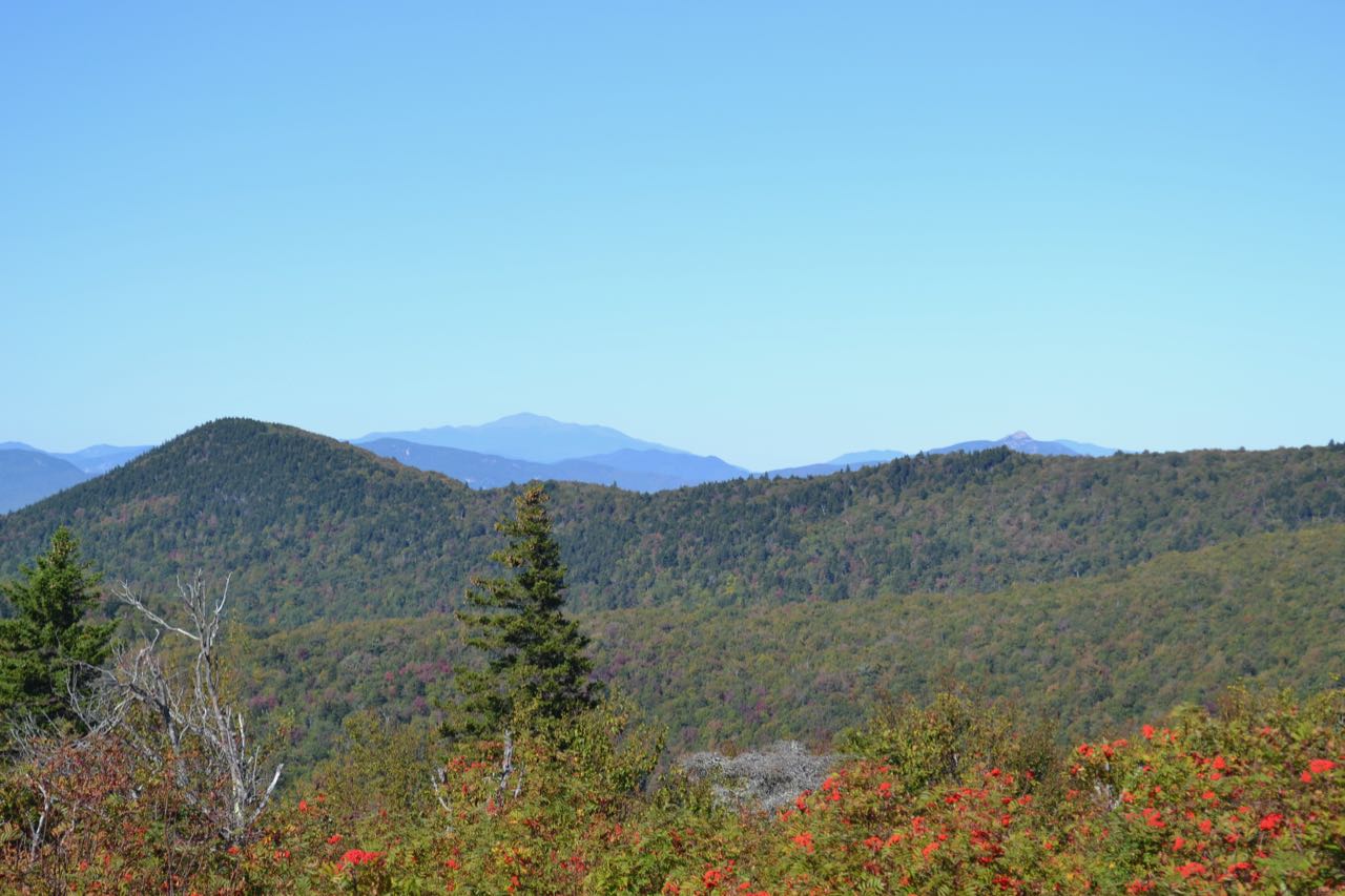
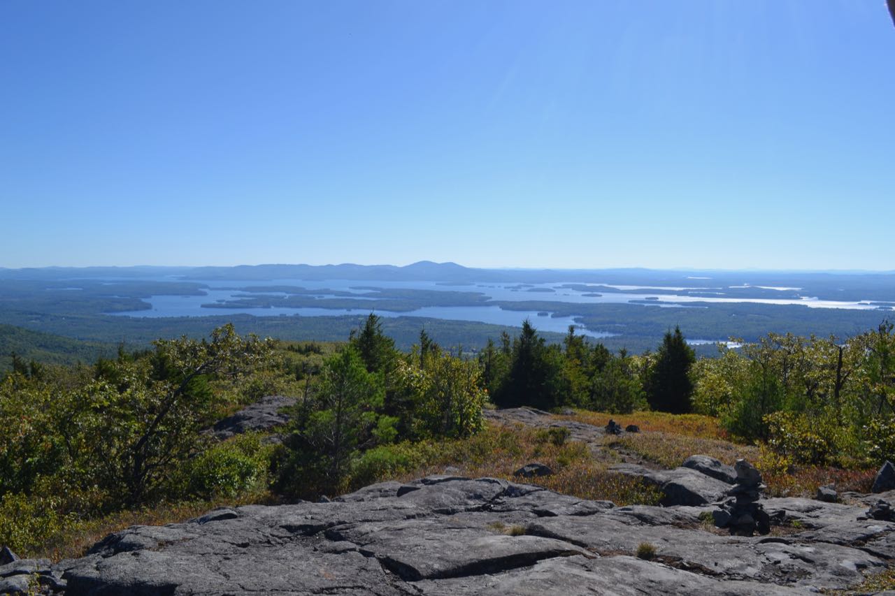
Though the summit of Mt. Roberts provides only a standing directional view of the Sandwich Range, the scenic trail passes over numerous open ledges with excellent views over the Lakes Region. The trail begins at Shannon Pond, the center of a trail network in the LRCT's Castle in the Clouds Conservation Area. From the pull-off at the kiosk, walk down the road toward Shannon Pond and turn left onto the dirt road (Cold Spring Road). If you parked by the ice cream stand, just continue straight past the pond. Bear left after a short distance toward the stables. Turn right at a sign and cross the field toward the Mt. Roberts Trail. The hike starts on a trail that is frequently used for horseback rides. The path is wide and easy. In 0.2 miles, pass Settlement Trail on the right. The trail then makes a long switchback and heads for the side of a horse pasture. Then, the hiking trail turns right and splits off from the horse trail. It ascends easily for 0.6 miles, then turns right as a short spur trail on the left leads out to the first of many viewpoints along the trail. This opening has a wide vista toward the lakes, the Belknap Range, and Red Hill. The trail continues more steeply upward over increasingly rocky terrain, reaching the first ledges in 0.4 miles. The trail now continues climbing in and out of the forest and over open ledges with increasingly better views.
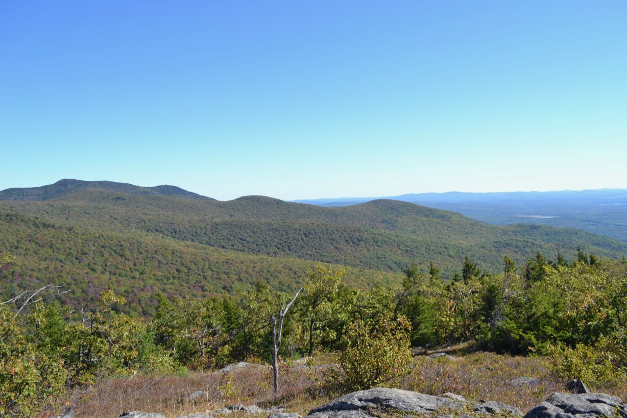
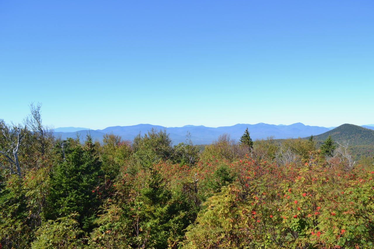
After 0.7 miles, the trail reaches the highest ledge, where there is a 180 degree view encompassing all of Lake Winnipesaukee. The centerpiece of the view is the Belknap Range. There is also a good look over the valley to the east at Mt. Shaw. While this ledge does provide the best view on the mountain, you shouldn't stop here. To get to the summit, continue on the trail as it climbs gradually first through a conifer forest, then through a grassy area. At a fork, bear right and continue a short distance to the summit, marked with a LRCT sign. Here, you will find a standing directional view north to the Sandwich Range. To make a longer loop hike over Faraway Mountain, see here.
Printable directions page