blah blah blah
Mt. Crawford
Length: 5.0 miles out-and-backDifficulty (click for info): Hard
Elevation Gain: 2100 feet
Rating (click for info): 8/10
Elevation: 3119'
Prominence: 259'
Driving Directions:
Parking lot and trailhead are on Rt. 302 in Harts Location, NH (summit is in Hadleys Purchase). The parking area is 12.3 miles west of Rt. 16 and 16.7 miles south of Rt.3, across the street from the Notchland Inn. The parking area is marked as "Davis Path Parking" and is a large dirt lot just above the river.
About the Hike:
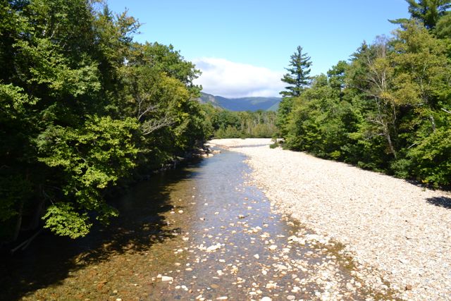
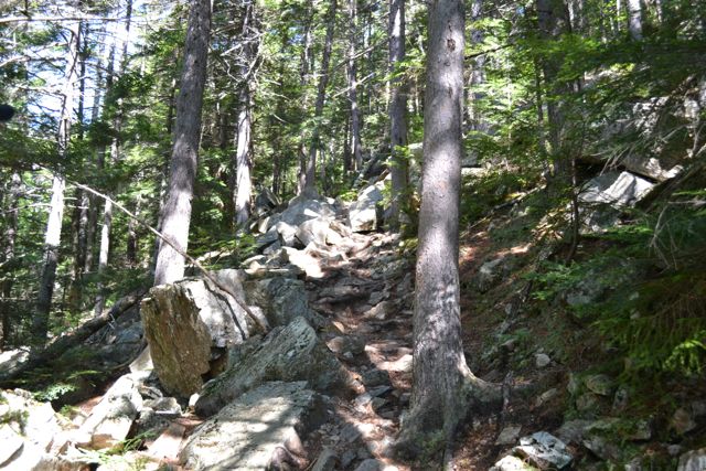
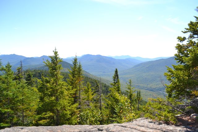
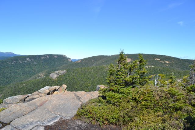
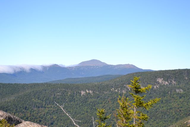
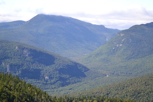
Situated near the south end of the Montalban Ridge, which runs through the center of the Presidential Range-Dry River Wilderness, Mt. Crawford's open summit provides a stunning view of the region just south of Crawford Notch as well as across this wilderness to the Presidentials. The hike is not too long, but the trail climbs relentlessly. From the parking area, walk 0.1 miles down the dirt road, then turn right and cross a suspension bridge over the Saco River. After crossing a few brooks, the trail enters the Presidential Range-Dry River Wilderness and begins its steep, rocky ascent. It is about a mile of relentless climbing to the first viewpoint, an open ledge with a fine view south to the Moat and Sandwich Ranges. In 0.2 miles from this ledge, turn left onto a spur trail which climbs 0.3 miles over expansive rock slabs to the summit. The Davis Path continues to the right to visit Mt. Resolution and Stairs Mountain.
Ledges on all sides of the summit provide excellent views. To the east, up the ridge are nearby Mt. Resolution and Stairs Mountain. Further north and east is the southern Presidential Range, from Mt. Webster, forming the east wall of the notch, to lofty Mt. Washington. On the other side is the Willey Range, with the Twin Range in the Pemigewasset Wilderness further to the left. To the west, directly across the notch, are Mt. Bemis and Mt. Nancy with Mt. Carrigain behind. Looking through the notch to the south is Mt. Tremont, with the Sandwich Range in the distance. The rest of the Moat Range continues further to the southeast.
Printable directions page