blah blah blah
Mt. Avalon
Length: 3.7 miles out-and-backDifficulty (click for info): Hard
Elevation Gain: 1550 feet
Rating (click for info): 7/10
Elevation: 3442'
Prominence: 100'
Driving Directions:
Trailhead and parking area are located at the Crawford Depot on Rt. 302, in Carroll, NH (summit is in Bethlehem). The Crawford Depot is 8.5 miles south of Rt. 3 and just south of the AMC Highland Center. Click here for a Google map.
About the Hike:
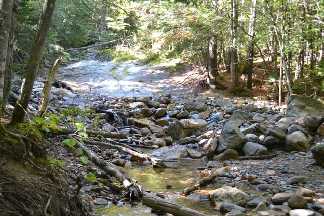
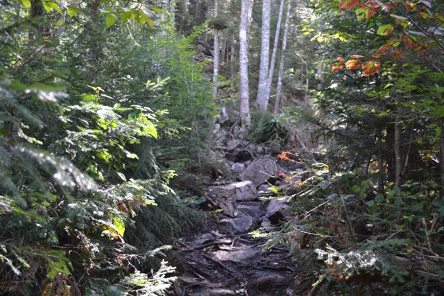
Mt. Avalon is just a small bump sticking out from the side of the side of the much higher peaks of the Willey Range, but its views more than match theirs, providing an impressive view of the Presidential Range across Crawford Notch. The trail starts at the Crawford Depot. Cross the railroad tracks at the Crawford Depot and head out on the Avalon Trail. Pass Mt. Willard Trail on the left in 0.1 miles and cross ledgy Crawford Brook in another 0.1 miles. Soon, a loop trail splits off toward the brook, passing Beecher and Pearl Cascades. This detour does not add any extra distance and is highly recommended. See more on its separate page. After the loop rejoins, the trail climbs moderately away from the brook. Soon, it passes a herd path on the left leading to a nice unnamed cascade. At 0.8 miles from the parking area, the trail recrosses Crawford Brook and climbs away on the other side. The trail soon flattens out for a while, then climbs to a junction half a mile from the last crossing. Turn left to stay on Avalon Trail as A-Z Trail continues straight. The trail soon becomes very steep and rocky, moderating near the end as it climbs half a mile to the low point between Mt. Avalon and Mt. Field. A spur on the left leads 0.1 miles and 100 feet up, involving one tricky rock scramble, to the minor summit of Mt. Avalon.
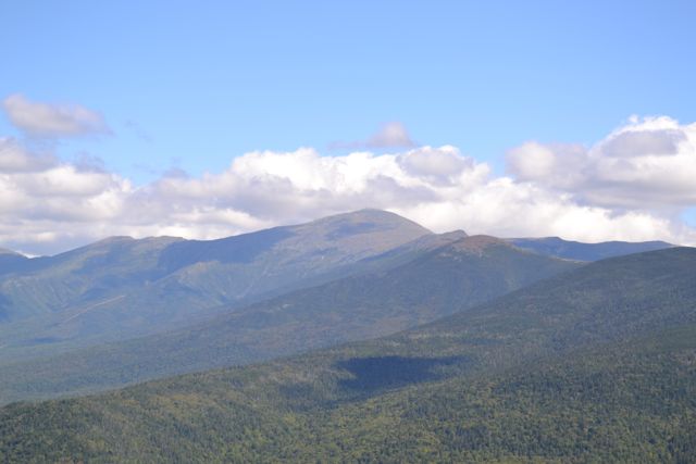
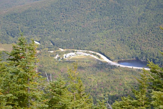
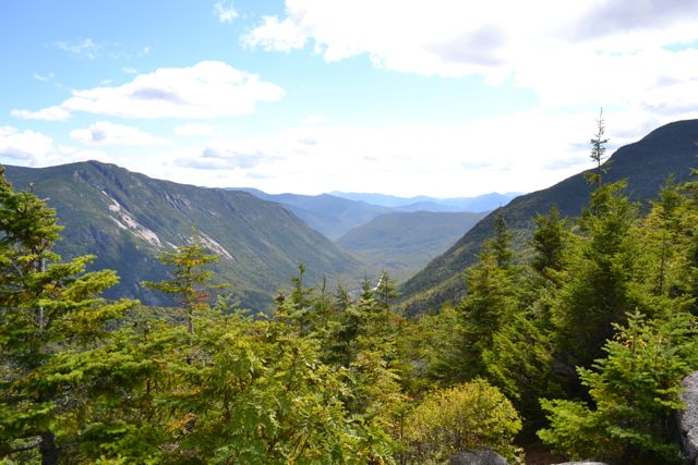
From the sharp, rocky top, there is a wide directional view. The vista looks down Crawford Notch to the south, along the dramatic Webster Cliffs. Beyond Webster are Mts. Resolution and Crawford, with the Moat Range in the distance. Behind Webster, the impressive ridge of the Southern Presidentials leads up to Mt. Washington. From lowest to highest, the peaks of Mt. Jackson, Mt. Pierce, Mt. Eisenhower, and Mt. Monroe rise from the ridge. Above Mt. Pierce is Boott Spur, and to the left of Mt. Washington are Mts. Clay and Jefferson. Across Jefferson Notch from Mt. Jefferson is the Cherry-Dartmouth Range, as seen from Mt. Field. Directly below, you can see the AMC Highland Center and Saco Lake.
Printable directions page