
blah blah blah
East Ponds
Length: 4.8 mile loopDifficulty (click for info): Easy
Elevation Gain: 1020 feet
Rating (click for info): 8/10
Elevation: 2600' (East) and 2596' (Little East)
Driving Directions:
Trailhead and parking area are on Tripoli Road in Livermore, NH. (Seasonal road - check status on TrailsNH to verify gate status). To get there, follow it 5.1 miles east of its junction with I-93 at Exit 31. The entrance to the parking area is on the left (north) side, marked by a hiking sign. Click here for a Google map.
About the Hike:
Tripoli is the name of the road that connects Waterville Valley with Woodstock across the remote mountain pass known as Thornton Gap and the valleys on each side of it. It's also where multitudes of skiers turn each winter to get to the Waterville Valley ski area. But it's also the name of a sedimentary substance - diatomaceous earth - used as an abrasive in a variety of products such as types of polish. The Livermore Tripoli Company maintained a dredging operation in this remote region, collecting and processing the skeletal remains of microorganisms beneath East Pond, for over seven years in the 1910's. East Pond remains the only location where this industry penetrated the White Mountains, and it is most known for its association with tripoli. Remains of the extensive mill buildings can still be found in the forest. East Pond, along with its smaller partner Little East Pond, lies on a shelf tucked away between the vertebrae of Scar Ridge and Mt. Osceola. Both waterbodies offer shoreside vistas of the rolling ridge above and are peaceful places to enjoy an afternoon amidst the historical setting of a bygone industry. Read all about tripoli at WhiteMountainHistory.org.
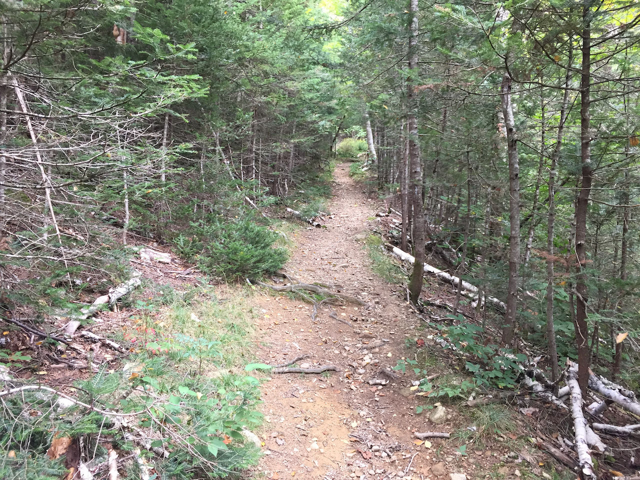
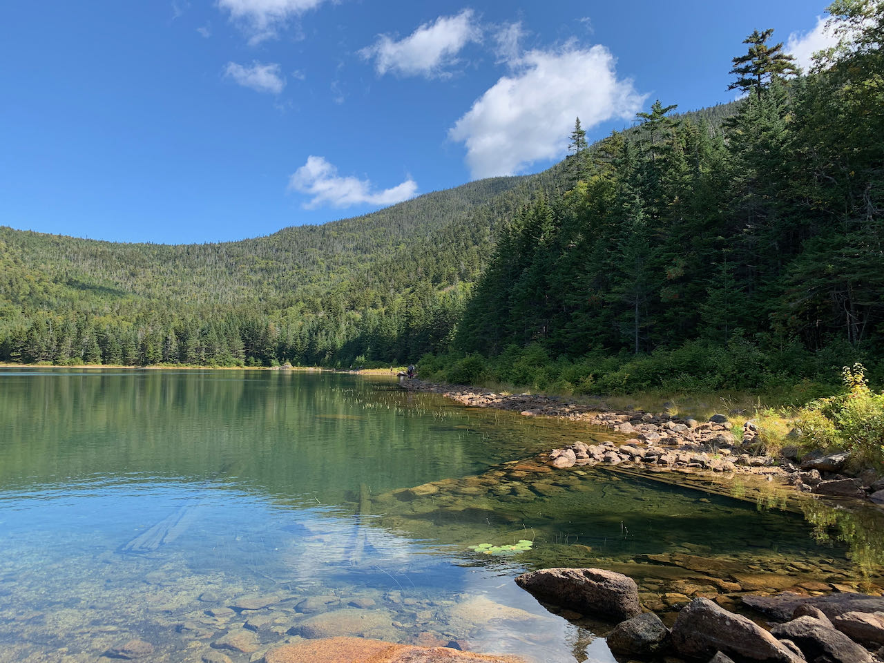
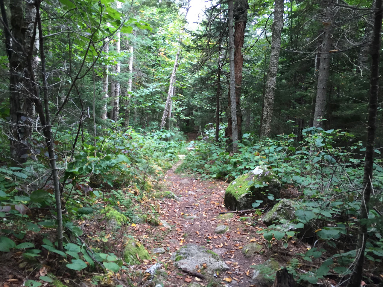
From the parking area, head up the East Pond Trail, beginning as a wide dirt and gravel path. Walk 0.3 miles to pass a clearing on the right and arrive at a trail junction, which will form the start of your loop. Stay straight on the East Pond Trail as it marches mildly upslope into the expansive hardwood forest. You trod the gradual terrain heading directly toward the pond through communities of hobblebush, and the trail soon approaches East Pond Brook (in about 0.15 miles). The path follows the babbling brook for a quarter mile, then swings left and crosses it on a wide wooden footbridge. It continues away from the brook, soon swinging uphill and right on its mellow approach. The trail eventually levels off and leads across the hillside into darker forest, reaching a trail junction in 0.55 miles. Left at this four-way is the East Pond Loop, which will take you later in your journey to Little East Pond. The pond is a short distance to your right, while ahead, the East Pond Trail continues to its alternate trailhead on the Kancamagus Highway. If you have extra time, it is worth venturing down this portion of the trail to seek out some alternate views of the pond, including from an unofficial path that explores the northern shore. At the standard destination, you step through some low bushes out onto the tiny gravelly beach at the south side of the pond, adjacent to the outlet, where the setting is unusually mesmerizing. An unnatural testament to the pond's history is visible in the shallow bed just up from where the water drains into the forest. Sunny days best bring out the emerald glow to the water, but it is a marvelous wonder at any time. On the left side, the shoulder of East Scar Ridge buttresses the valley. On the right side, the equally imposing profile of Mount Osceola's west peak towers. In between, the ridge dips curvaceously to its low point, which the northward East Pond Trail surmounts, still 500 feet above the water.
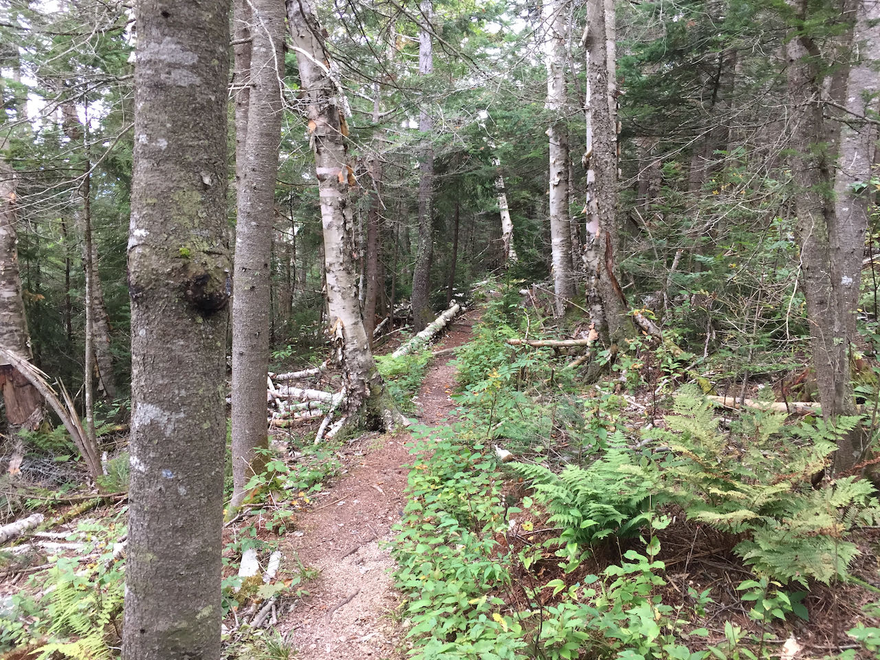
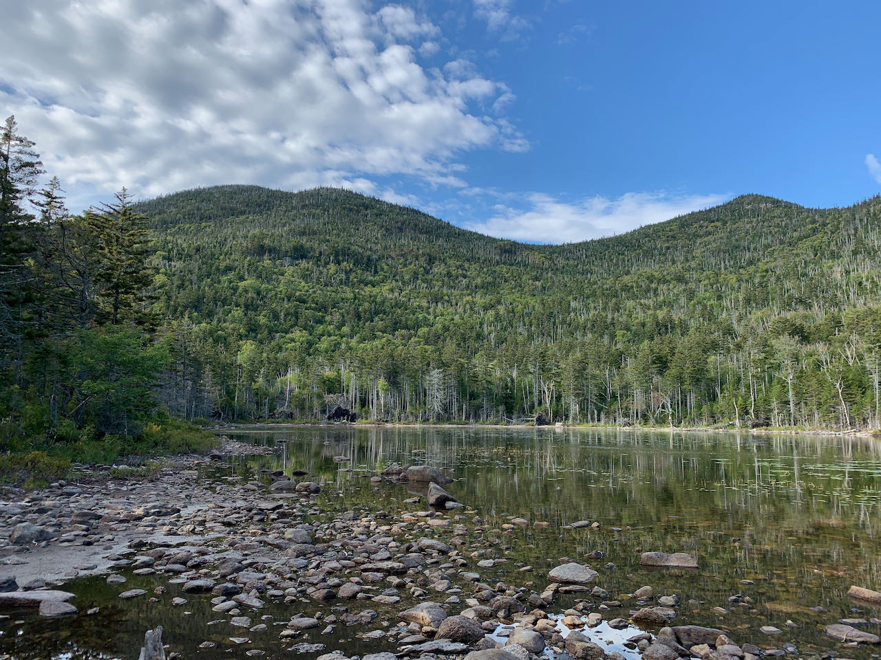
East Pond and Little East Pond both lie in hollows between the lateral ridges extending from Scar Ridge. The trail connecting them must traverse two of these ridges, along with the hollow in between, where there is no pond. Take the East Pond Loop from the four-way junction as it climbs easily through shadowy spruces for about a quarter mile to level off, cresting the first of the two ridges. The trail then descends at a very gradual pace across the contour for about 0.35 miles to cross the brook which drains from between the two ridges. The next climb, becoming a bit steeper but still moderate, leads not even 0.2 miles to the trail's highest point on the second ridge, where the trail enters into an area of brighter birches. A very gentle descent follows, as the trail wraps around the long arm of the ridge, heading straight then curling right, approaching the shores of Little East Pond after another 0.7 miles. With the water in sight ahead, bear left to avoid an abandoned path, and reach a junction where a short spur trail takes you a few steps right to the shore. The scene is in bleak contrast with the cheerier big pond. Barren snags line the stone-rimmed waterline, and clusters of lily pads splotch the shallower waters. Here the backdrop is a whole different segment of Scar Ridge; none of what was visible from East Pond can be seen from here. The rounded double humps of the highest, western Scar Ridge are the prominent feature to the left, while in the center, the conical rise of Middle Scar Ridge shows off its high southern ledges. The shore is less conducive to aimless exploring than East Pond, but the on-trail mini-beach is still an enjoyable place to relax and enjoy the sights of the stark terrain.
When you're ready to leave, follow the path back from the pond to the junction and continue straight downhill on the Little East Pond Trail. You follow the pond's outlet, the aptly-named Little East Pond Brook, for a short distance before the brook pulls away and the trail maintains a straight and steady descent. After half a mile, it begins to swing back to the left in the direction of returning. The trail beelines down through recently-logged woods for half a mile, eventually joining one of the region's many old logging railroad grades. With just over 0.6 miles to go, the trail crosses the first of four evenly-spaced brooks (this one named Clear Brook), each of which features an exagerated ditch in the railroad grade. No bridges assist crossing, but most have decent stepping stones. In between the brooks, the going is good along the arrow-straight grade, where the berms were built to last. The final brook to be crossed, East Pond Brook itself, is an easy tenth of a mile away from the loop junction, where you can turn right to return the way you came to the trailhead.
Printable directions page