blah blah blah
Boulder Loop Trail
Length: 3.1 mile loopDifficulty (click for info): Moderate
Elevation Gain: 920 feet (+70 feet on descent)
Rating (click for info): 6/10
Elevation: 1770'
Prominence: 31'
Driving Directions:
Trailhead and parking area are on Passaconaway Road in Albany, NH. Passaconaway Road leaves the east side of the Kancamagus Highway about 6 miles west of Rt. 16 and 29.2 miles east of Rt. 93. This road is marked with a brown sign for the Covered Bridge Campground and the hiking trail. Drive down this road, past the parking area on the right and across the Albany Covered Bridge. Turn right to stay on Passaconaway Road, then immediately turn right again into the parking area. Click here for a Google map.
About the Hike:
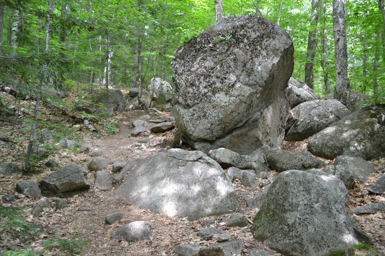
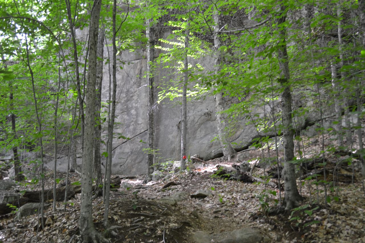
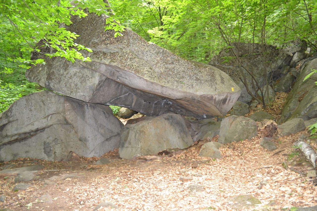
The Boulder Loop Trail is a scenic hike through a boulder field and out to a ledge viewpoint on the side of the Moat Range. The trail starts near a campground. From the parking area, cross the road and head into the woods. After a 0.2 mile walk, the trail splits into a loop. Bear left onto the west fork. From the split, you will start to see many small boulders along the trail. The trail soon turns a corner to face an enormous cliff. It climbs alongside the cliff before making a few short switchbacks and heading straight uphill. After 0.6 miles of climbing (since the loop junction), the trail comes out to a small ledge opening from which you can look up at the taller cliffs you will climb to next.
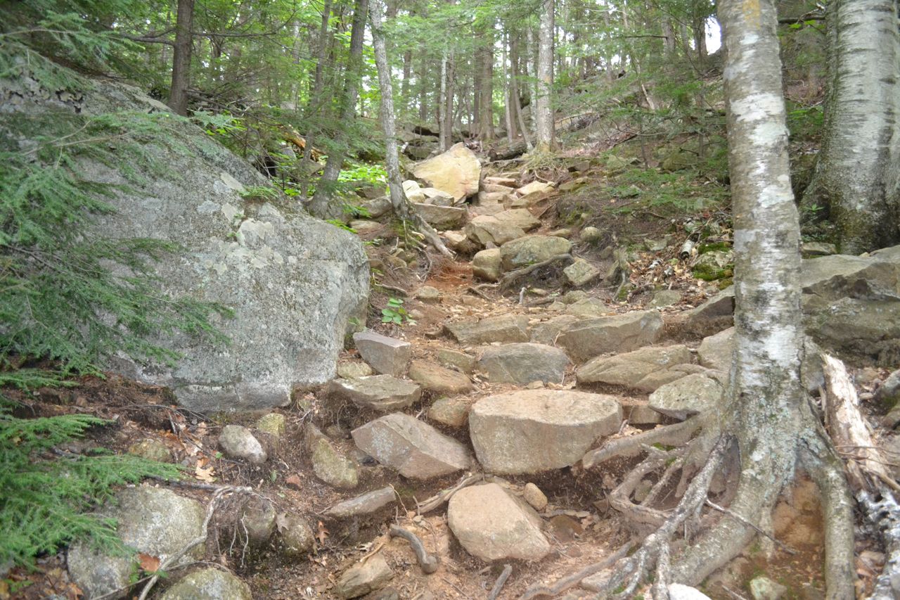
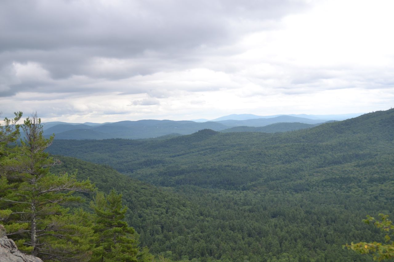
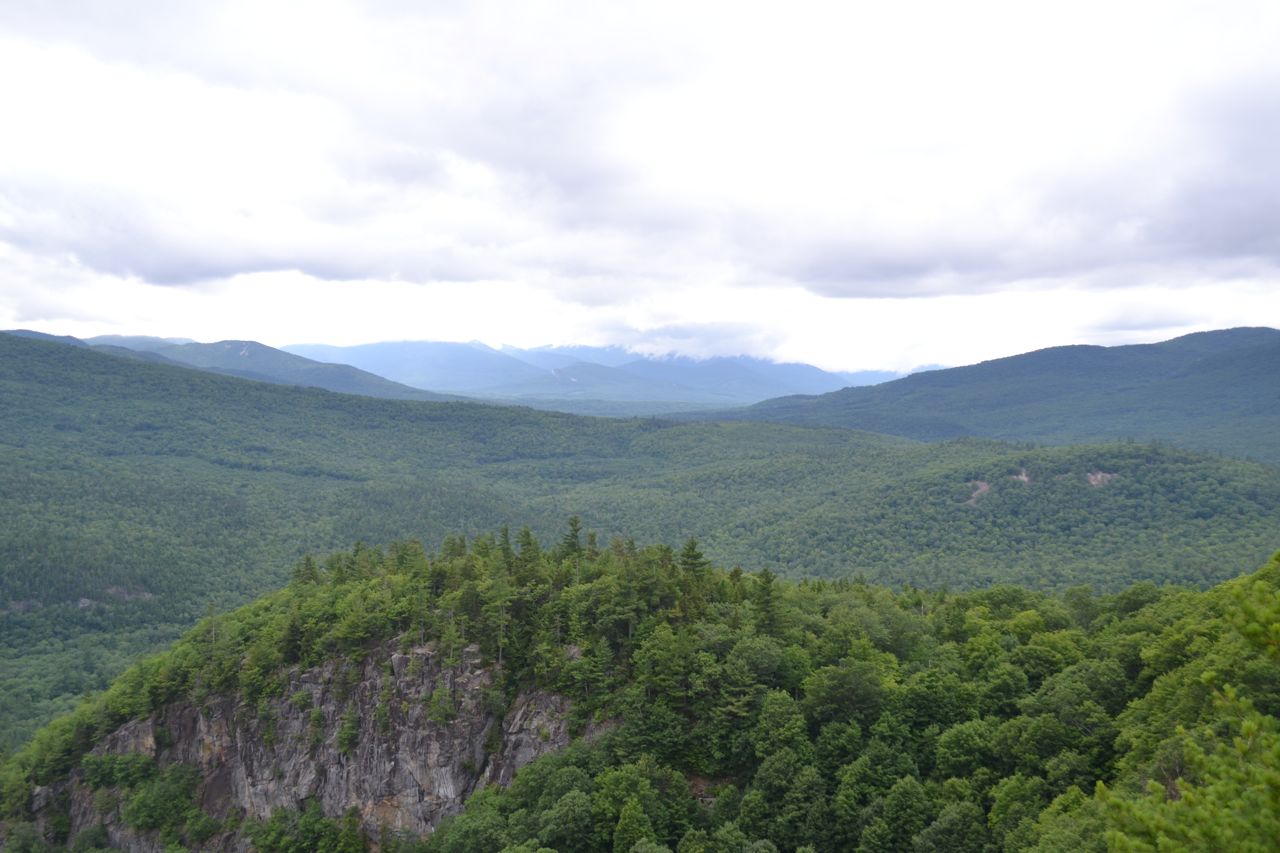
Going back into the woods, the trail runs flat for a short distance before swinging around behind the main ledge and ascending from the back, reaching the top 0.5 miles past the first viewpoint. A spur trail on the right leads 0.2 miles down across a series of ledges to the most open overlook. The sprawling rock presents an overview of the rolling Swift River Valley amidst the mountains, looking up and down the Kancamagus Highway. With Mt. Chocorua across the way and the surrounding cliffs, there is a rugged atmosphere to the area. When finished exploring the ledges, return to the trail and continue down the other side of the loop. The trail descends the slope behind the main cliffs on a series of stone steps. After 0.4 miles, the trail comes on the level with the bottom of the cliffs and swings right toward the boulder field. It weaves around and through the large rocks, running out gentle terrain for 0.8 miles back to the loop junction.
Printable directions page