

blah blah blah
Hermit Falls
Length: 2.8 miles out-and-backDifficulty (click for info): Beginner
Elevation Gain: 230 feet (+70 feet on return)
Rating (click for info): 6/10
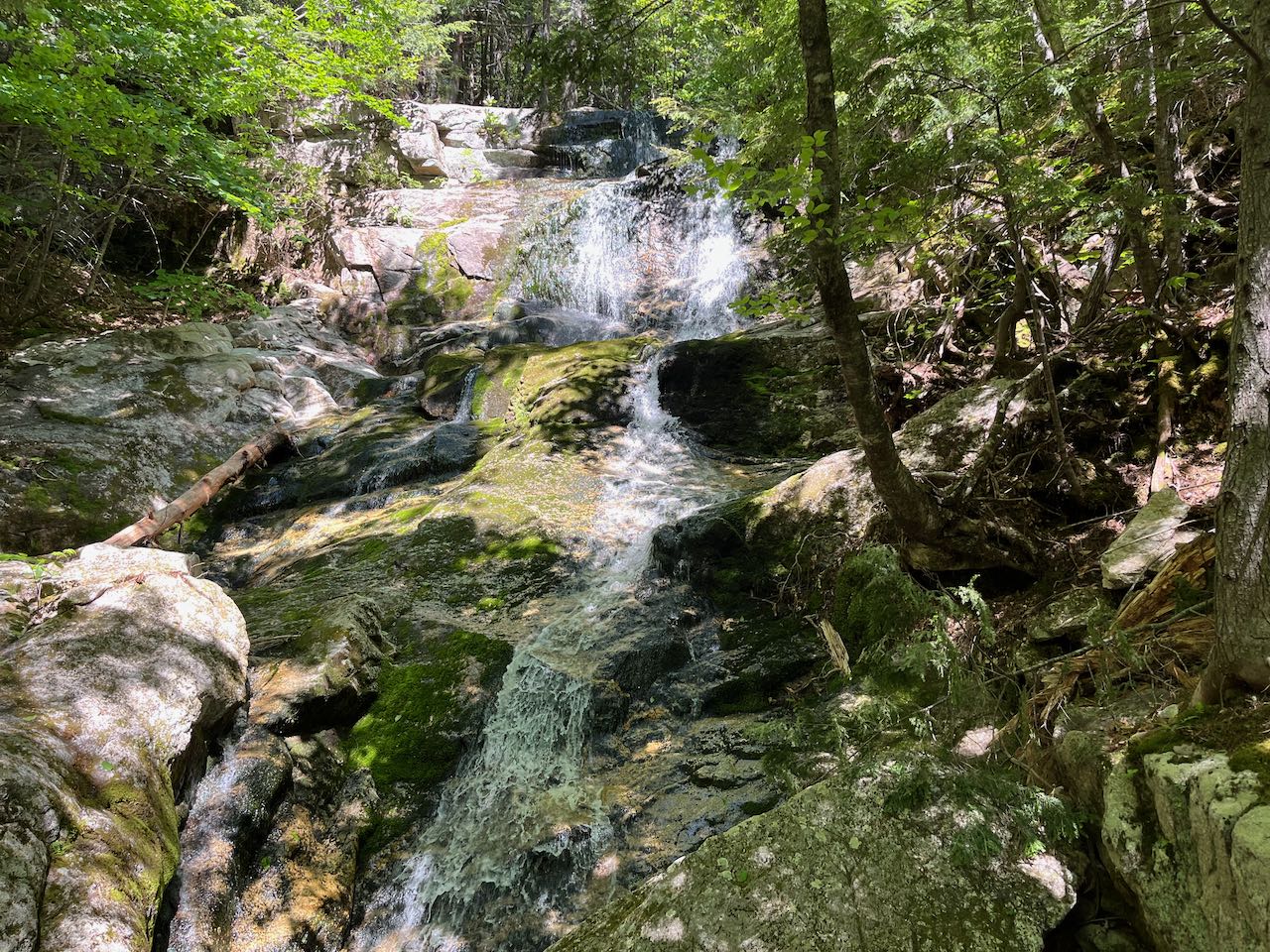
Height: 30'
Source: Basin Brook
Driving Directions:
Trailhead and parking area are on Basin Road, in the Basin Campground, in Chatham, NH. The entrance to the campground is on the west side of Maine State Route 113, 10.8 miles south of Rt. 2 and 5.3 miles north of the northern end of the Rt. 113B loop. Heading north, it is just before the seasonal gate and Maine state line. Drive 0.6 miles into the campground (stay right at the entrance) and turn right into the parking area at the boat ramp into Basin Pond. Rt. 113 through Evans Notch is closed from late fall through early spring, as is the road into the campground, meaning during this time of year, you can only approach from the south, park at the entrance to the campground, and walk 0.6 miles in. Click here for a Google map.
About the Hike:
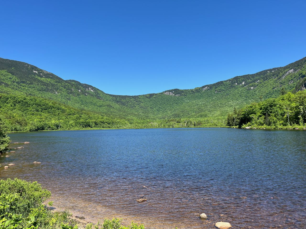
On the far east side of the White Mountains by the Maine border, one of the more unique features of the Baldface Range is a horshoe-shaped mountain wall called "The Basin". In places, the cragged slopes rise over 2000 feet from the floor of the low-lying bowl, not far above the Cold River on its way down to the Androscoggin. Despite sharing its name with the popular tourist stop in Franconia Notch, the Basin is not known for waterfalls, but one scenic waterfall can indeed be found in its secluded interior. Hermit Falls is a moderate-sized cascade dropping over a ledgy brook bed. The cascade occurs at the bottom of the steep Basin walls, so the hike into the Basin is an easy forest stroll.
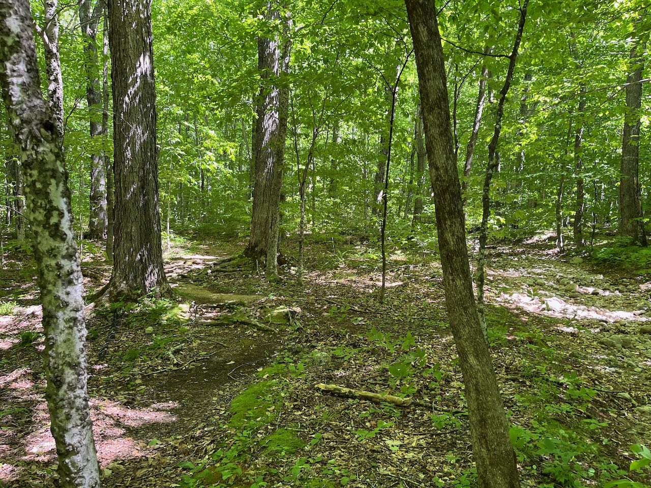
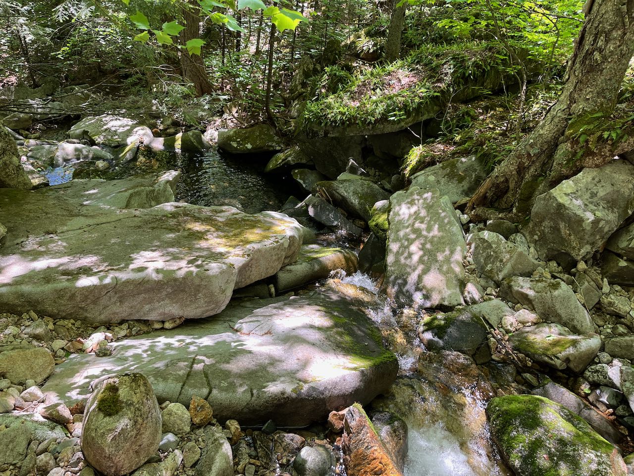
The hike to Hermit Falls begins just up from Evans Notch in the floor of the Basin, with stunning views of the whole formation from the shores of Basin Pond. The waterside from around the boat ramp and dam affords sunny views of the curvy mountainsides and striking cliffs on West Royce. Though manmade, Basin Pond's shimmering blue waters blend in with the beautiful natural scenery. Walk from the parking lot across the boat ramp access road to the trail sign. Walk into the woods on the Basin Trail. The trail traverses the stony terrain between Basin Pond and the nearby campground, crossing several faint paths from the campsites down to the water. After a quarter mile, the trail approaches the shoreline of the pond with another nice view of the cliffs across the water. It then crosses two small brooks over the next 0.1 miles. Shortly after the second, the trail approaches the marshy west end of Basin Pond, with more views of the cliffs. It passes the end of the pond, and after 0.35 miles, crosses the main inlet brook, Basin Brook. Watch closely for an arrow sign where the trail crosses the shallow, gravelly brook. Not far past the crossing, the trail crosses a much drier brook which used to be the main channel on a wooden bridge. Now fully inside the Basin, the trail starts to follow old roads through the flat floodplain-like interior where many streams flowing down from the mountains converge. The trail crosses another smaller brook about 0.4 miles after the first one. Then in another 0.15 miles, reach a junction where the loop to Hermit Falls splits off. Bear left and continue for 0.15 miles, joining Basin Brook again, to the falls. The trail steepens very briefly and climbs over roots and rocks up to the middle of the waterfall. Ahead, several tiers of the waterfall cascade over mossy ledge. It is somewhat seasonal and can get dry during the summer months. Below the best viewpoint, the stream drops again through several interestingly shaped rocks into a small pool. The trail continues steeply up past the cascades and reconnects with the main trail, but you can return the way you came. A longer hike can be fashioned by continuing up the trail, which climbs very steeply through cliffy terrain up to the Basin Rim.
Printable directions page