


blah blah blah
Devil's Hopyard
Length: 2.6 miles out-and-backDifficulty (click for info): Easy
Elevation Gain: 190 feet (+30 feet on return)
Rating (click for info): 6/10
Driving Directions:
Trailhead is at the end of South Pond Road in Stark, NH. The last mile of South Pond Road is seasonally gated - check status on TrailsNH to verify gate status. In season, the road typically adheres to a schedule of 10:00AM-8:00PM and there is an $8.00 charge for parking. South Pond Road starts on the south side of Rt. 110, 10.2 miles east of Rt. 3 in and 3.6 miles west of Rt. 110A. Drive 0.4 miles down the road and bear right at a fork. In another 0.4 miles, turn right to stay on the road and reach the seasonal gate. If it is closed, park here and walk just over a mile down the road. If it is open, drive 1.1 miles down the road to the park. Click here for a Google map.
About the Hike:
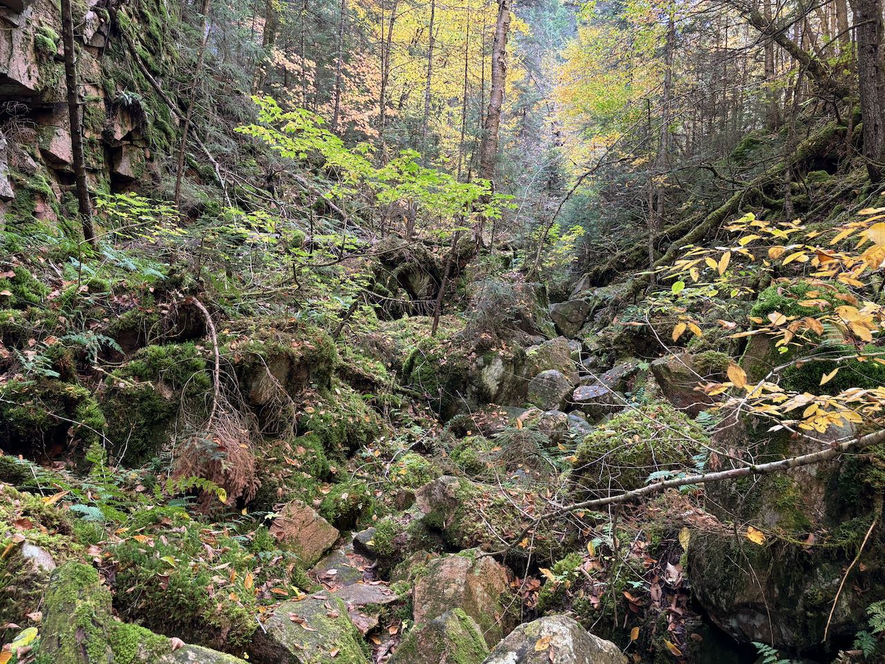
You can probably guess that something is trying be communicated by the name of this place - Devil's Hopyard ("playground"). It's a bizarre-looking, rather inaccessible canyon of sorts, and as typical in the White Mountains, found in an unexpected place where the terrain is otherwise gentle. The difficulty of hiking into Devil's Hopyard is hard to gauge, as it can be left to each visitor to choose their own adventure. Thus, we've ranked it as easy - all that's required to experience some of its unusually captivating environment is a simple walk through the woods. If you choose to venture all the way into the gorge, be warned - the trail clambers over mossy and slick boulders with deep holes between them. It's a hostile area for hiking, but if you make it to the end of the trail you'll find some wild delights in its towering cliffs and underground stream.
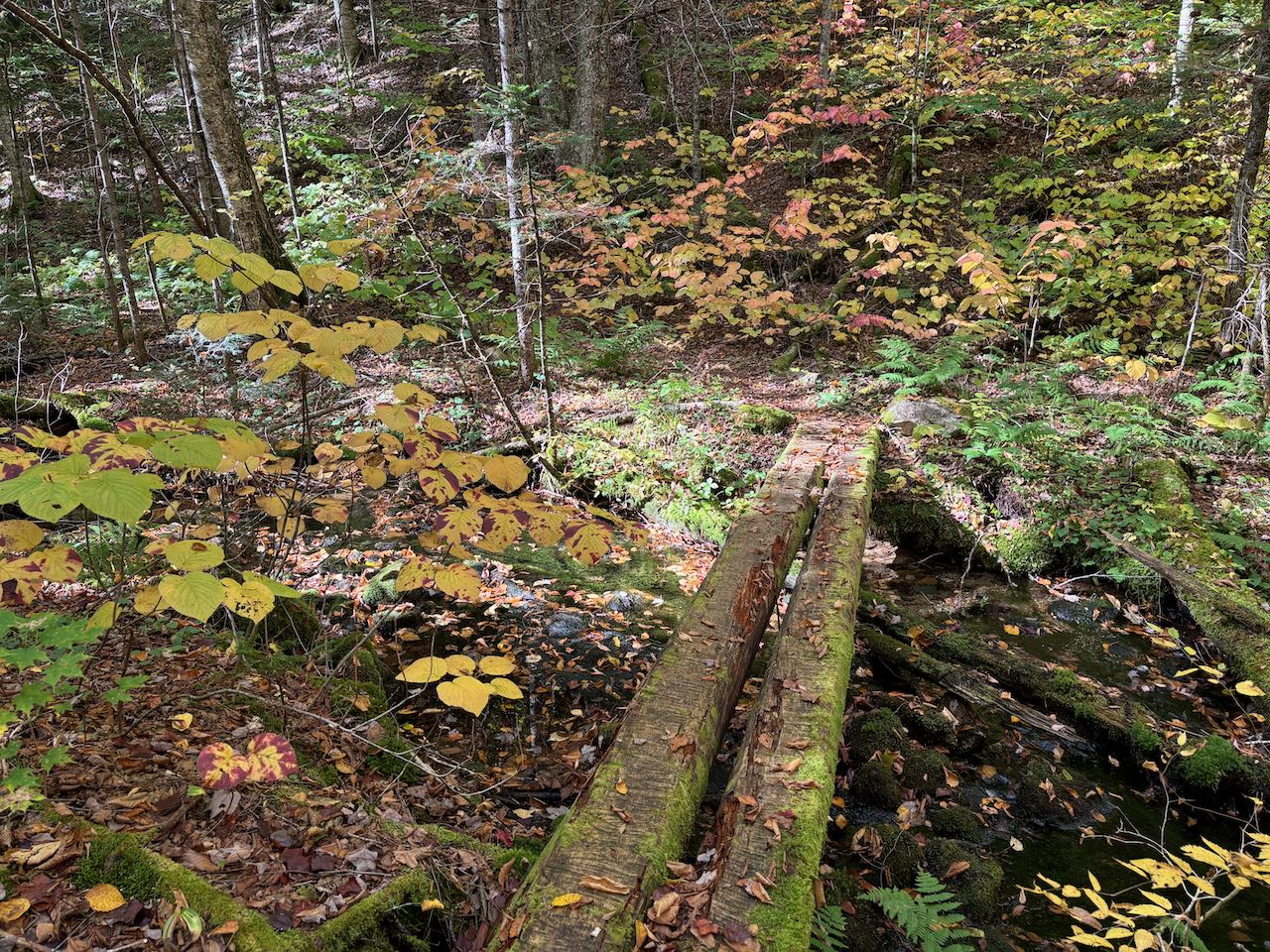
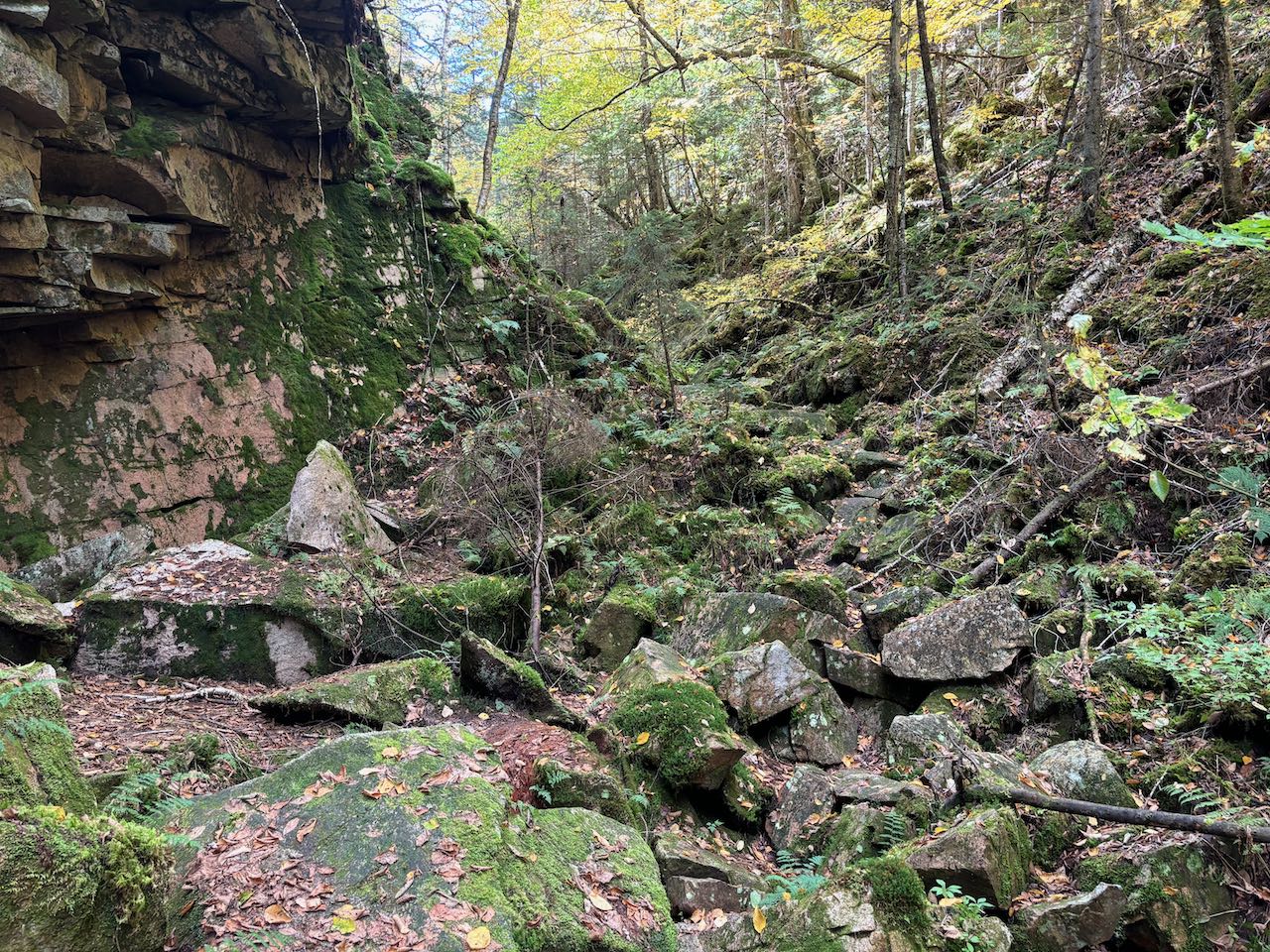
From the parking area, walk down toward the lake and head all the way to the right. Look for the kiosk at the edge of the woods, where the Kilkenny Ridge Trail finds its northern terminus. Follow the wide path along the shore of the pond, with a couple openings near the beginning with nice views over the reflective waters toward Location Hill. The trail hugs the shoreline for 0.4 miles before gradually pulling away. It rises ever so slightly through the cheery forest for another 0.3 miles. After crossing a log bridge over Devil's Hopyard Stream, it arrives at a trail junction. Bear right at the fork onto Devil's Hopyard Trail. The trail follows the brook for another 0.1 miles and then crosses back over to the other side on another log bridge. The trail leads into the tightening ravine as tall, thin birches and hemlocks arch over the valley. Mossy rocks start to encroach on the trail, and the vegetation becomes tangled over the stream as the color green invades. After another 0.2 miles, the trail appears to end back at the stream, which is now concealed underneath the jumbled boulders. Look for wildflowers growing on the moss; red trilliums are especially abundant here. This is a good place to end your trek; if you're looking for greater adventure, continue on the trail as it leads over the rocks on top of the stream and climbs up a pile of boulders over a "gateway" into another chamber of the ravine. The footing in this part of the trail is highly unsteady, with angled rocks and slippery moss underfoot. The trail leads past a set of blocky cliffs overhanging the trail. It rounds a corner and continues over the mess of rocks as the sounds of the burbling stream eminate from just underneath your feet. The trail eventually takes a minor diversion from all the rocks, as it becomes narrow and overgrown. It then follows along the base of a huge, more vertical cliff face where the tree canopy opens up overhead. It runs abruptly into an "end of trail" sign after 0.3 miles entrenched in the unforgiving terrain of the hopyard.
Printable directions page