blah blah blah
Skatutakee and Thumb Mountains
Length: 4.7 miles out-and-back with loopDifficulty (click for info): Moderate
Elevation Gain: 1020 feet (loop total)
Rating (click for info): 6/10
Elevation: 1998' (Skatutakee) and 1988' (Thumb)
Prominence: 608' (Skatutakee) and 178' (Thumb)
Driving Directions:
Trailhead and parking area are at the Harris Center on Kings Highway in Hancock, NH. From Rt. 123, 2.2 miles northwest of the western junction of Rt. 123 and Rt. 137 in the center of Hancock, turn southwest (left, from the town center) onto Hunts Pond Road. Travel 0.5 miles, then turn left onto Kings Highway. Continue 0.7 miles and turn left again into the entryway to the Harris Center. An overflow parking area is located just a bit further down the road on the other end of the main building. Click here for a Google map.
Trail Map
About the Hike:
Skatutakee and Thumb are two small mountains located in the center of the Monadnock Region, on the property of the Harris Center for Conservation Education. They both have views to the east, in slightly different directions. Skatutakee offers a wider view that is partially restricted by brush, while Thumb presents a smaller, but more dramatic view from a rocky clearing. It's an excellent half-day adventure with plenty of scenery that's especially pleasing in fall foliage.
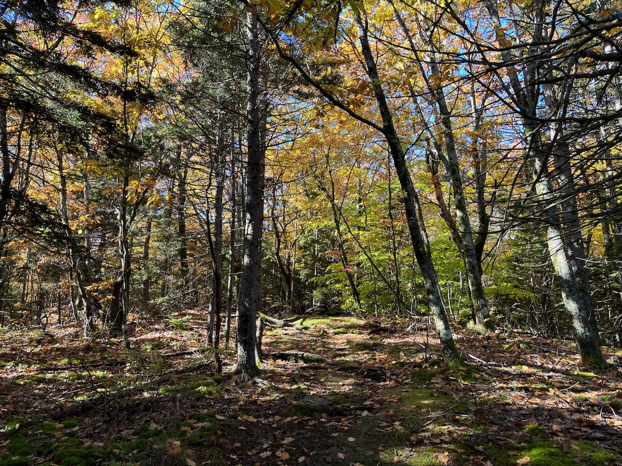
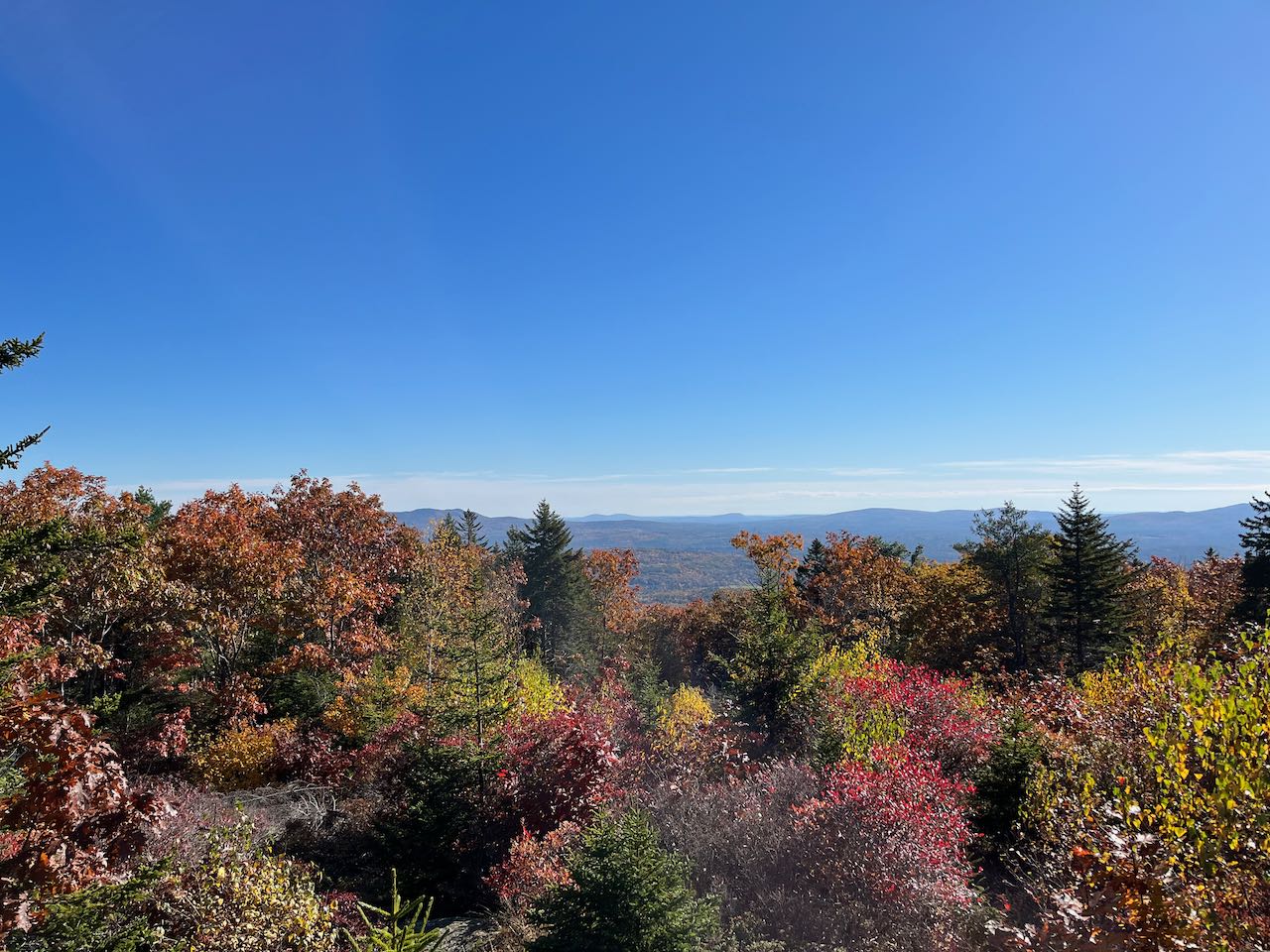
The Harriskat Trail starts at the kiosk across from the Harris Center building entrance. Follow the footpath down to the road and cross to the trailhead proper on the other side. The trail climbs up away from the road, then levels off and meanders through an open forest. At several points around the initial section of the trail, you will find delicately crafted wood carvings of animals fashioned from dead wood around the environment. Twist through some boulders and cross a few log bridges over wet depressions until a point 0.6 miles from the start, where you will find your loop junction. Bear left to continue on the Harriskat Trail toward Skatutakee first. The trail swings left toward the slope of the mountain after your approach on mostly flat terrain. It climbs by means of long S-curves, and the grades are gentle. Stonewalls are a common sight criss-crossing the forest, evidencing the area's pastoral past. After 0.65 miles, you will reach the middle of a plateau and pause before proceeding up toward the summit. More conifers mix into the bright woodland as you climb the slightly steeper slopes. As you approach the top, the trail winds through open areas with low growth. After 0.35 miles, you will arrive at the summit ledge, topped by a sturdy cairn with a single seat built in. Enjoy the view across a large cleared meadow and over the treetops. On the left, you can see Crotched Mountain around the trees, along with the twin hills of the Uncanoonuc Mountains and the square rise of Joe English Hill. The main feature of the view is a full shot of the Wapack Range, notably the two Pack Monadnocks, which are closest. Around the right side of the clearing, the treetops block out the view except for Mt. Monadnock, which rises above.
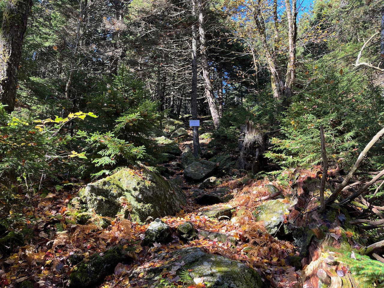
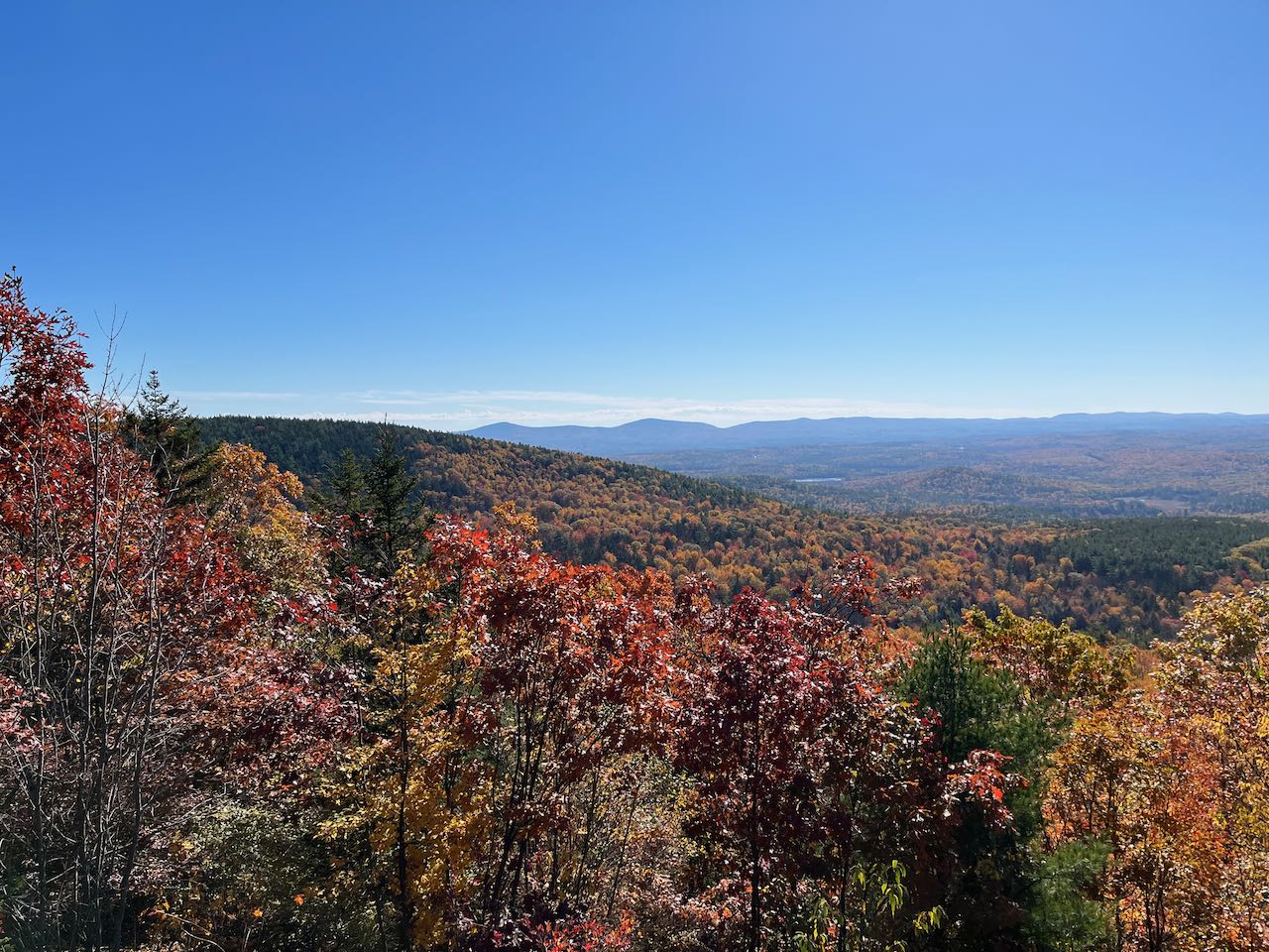
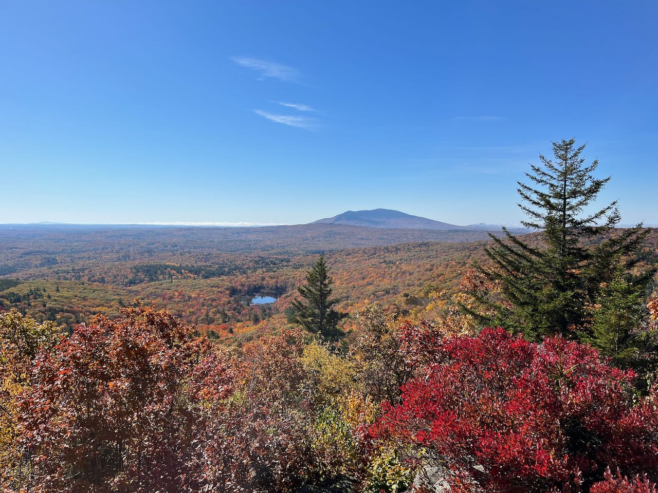
To continue to your next destination, continue past the summit and take an abrupt right onto Thumbs Up Trail as the Cadot Trail diverges to the left. Descend from the summit on a moss-lined pathway that soon transitions into a grove of diminutive spruces as the trail drops off a steeper slope. After 0.3 miles, you reach the bottom of the ridge connecting the two mountains. The trail follows the top of the ridge across, which remains very level for the next half mile. After a series of twists and turns and minor ups and downs, you will arrive at a junction, where Thumbs Down Trail, your descent route, continues straight, while Thumbs Up Trail continues as a spur to the top of Thumb Mountain. Turn left to stay on Thumbs Up as it surmounts the steepest and rockiest pitch of the hike. This quickly subsides and the trail continues easily across the broad summit area. After 0.3 miles, the trail passes the summit and leads through a stone seating area and down to the outlook ledge. It leads to a stone seating area near the summit. The unrestricted view to the south rolls down the mountain slopes across the valley, with an unnamed pond punctuating the terrain close by. You can look back to Skatutakee on your left. The full sweep of the Wapack Range is again visible, from the Pack Monadnocks across Temple Mountain and Barrett Mountain and down to Mt. Watatic. The center of the view gazes out into the flatlands of Massachusetts, with Wachusett Mountain as the one distnat feature interrupting the plain. Behind the pond, forming pictureque geometry, is Mt. Monadnock, flanked by Little Monadnock on its right.
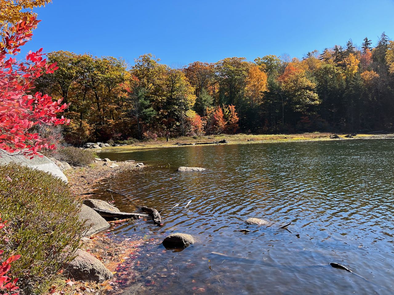
Return to the junction and take a left onto the Thumbs Down Trail as it descends with alternating moderate and gradual drops. After 0.35 miles, the trail levels off and soon Jack's Pond comes into view on the right. The trail descends to a clearing on its shore after another 0.2 miles, where there is a nice view over the waters to the surrounding hillside. The trail then turns left and descends away from the pond for 0.1 miles before swinging back to the right on the bed of an old road and crossing the outflow from the pond. After 0.2 miles on the road, follow signs to the right, bearing off the road you were on and crossing another. The trail then makes a wide curve through a hollow and climbs around a steep slope to arrive back at the loop junction, where you can follow the Harriskat Trail back to the parking area.
Printable directions page