blah blah blah
North Percy Peak
Length: 4.4 miles out-and-backDifficulty (click for info): Very Hard
Elevation Gain: 2200 feet
Rating (click for info): 9/10
Elevation: 3430'
Prominence: 800'
Driving Directions:
Trailhead and parking area are located on Nash Stream Road in Stratford, NH. Take Emmerson Road from Rt. 110 in Groveton, 2.6 miles east of Rt. 3. In 1.4 miles, bear right onto Northside Road. Continue 0.7 miles and turn left onto Nash Stream Road. Nash Stream Road is not signed; it is across from a cemetery at a turn in the road. The parking area is about 2.6 miles down Nash Stream Road, just before a bridge.
About the Hike:
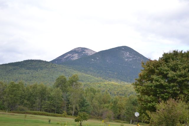
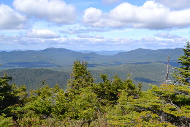
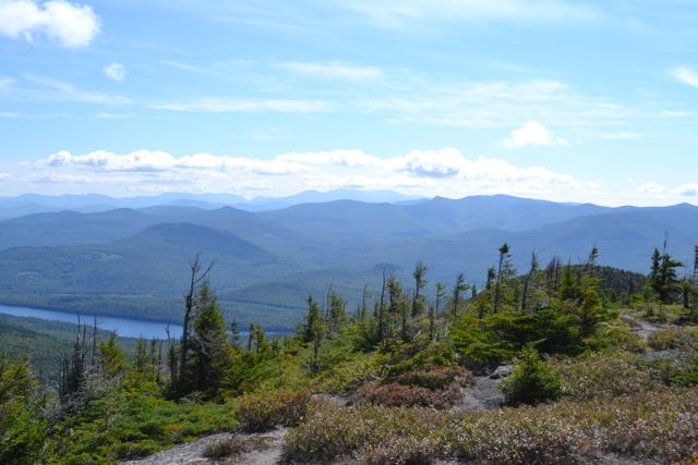
Located at the southern end of Nash Stream Forest, the Percy Peaks are the most easily recognizable mountains in the Great North Woods. North Percy's enormous scarred granite dome is quite a striking feature, and one which makes for a difficult climb. Sections of the trail, especially near the summit, are among the most challenging in the area. But aside from being a competitor for the positions of most unique and most difficult in its area, North Percy is most certainly a qualified contender for the having the most beautiful summit view.
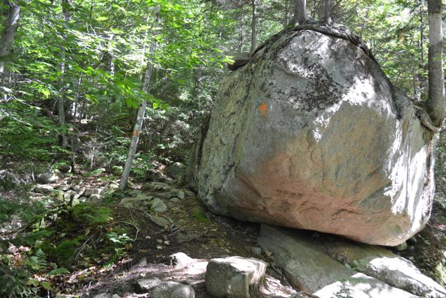
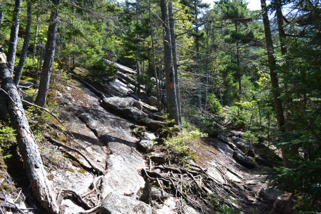
From the parking area, cross the bridge and walk a short distance up the road to the inconspicuous trailhead. The Percy Peaks Trail enters the woods and joins Slide Brook. It climbs at an easy grade, not an indicator of what is coming. It briefly veers away from the brook to cross a seasonal stream, then returns. After one mile, the trail passes a large boulder and turns away from the brook to begin climbing up many sets of stone stairs. At the top of the stairway, the trail abruptly runs into the first of the rock slabs. This section is very steep, and can be dangerous when wet. The trail climbs along the side of the slabs at first, where there are trees to grab onto, then as the grade eases slightly, it heads across them. Views open slightly as you climb. After 0.4 miles, at the end of this tiring climb, you get a break from the steep rocks and scrambling as the trail traverses the wild ridge between North Percy and its twin, South Percy. Soon, pass Old Summer Club Trail on the right. This trail can be used to access a rough spur to South Percy, an interesting side trip if you have time. Just past this, bear left again as Percy Loop Trail goes right.
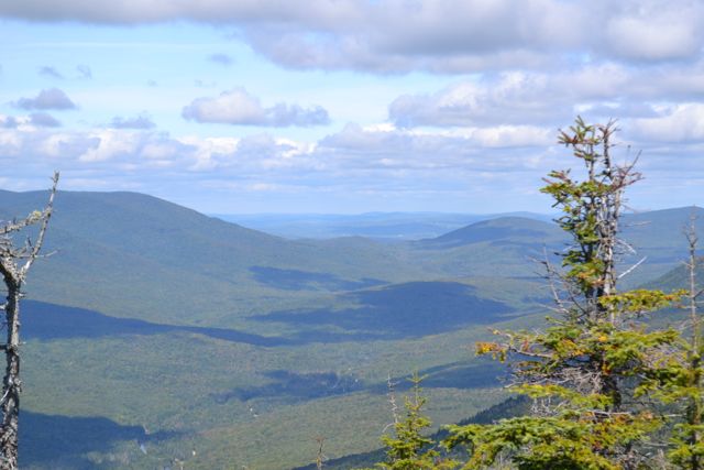
When you reach the base of the summit dome, the trail once again becomes extremely steep for the last 0.3 miles. Use caution when climbing the bare rock, where there are no trees for support. Wide views open quickly. The area around the actual summit is very wide and flat, in contrast to the steep terrain around it. The view from the top is stunning. Some of the view is blocked by small fir trees, but you can still see in all directions by walking around. To the south, the northern Presidentials are visible. To the west, you look down on South Percy Peak and the city of Groveton. The view to the east extends into Maine, and is partially blocked by nearby Long Mountain. To the north are the mountain ranges in the northern regions of Nash Stream Forest.
Printable directions page