blah blah blah
Magalloway Mountain
Length: 1.9 mile loopDifficulty (click for info): Easy
Elevation Gain: 840 feet (+60 feet on return)
Rating (click for info): 9/10
Elevation: 3383'
Prominence: 1013'
Driving Directions:
Trailhead and parking area are on a branch of Magalloway Road in Pittsburg, NH. Magalloway Road is a logging road which begins on Rt. 3, 11.6 miles north of Rt. 145. There is no sign for the road, but the entrance is very wide and there is a marker for the lookout tower. As you go, ignore any diverging spur roads that look rougher than the main road. Also, you are required to yield to logging trucks, which will probably force you off the road if you don't. Drive 1.2 miles and continue straight (right) at a fork just after a bridge over the Connecticut River. In 1.7 miles past the bridge, take the left fork to stay on Magalloway Road as Cedar Stream Road goes right. In another 2.4 miles past this junction, turn right, leaving the main road onto a spur road (sometimes called Tower Road) marked with a sign for the tower. Use caution, as this road is much rougher and steeper. Low-clearance vehicles may not be able to drive this road. Follow it for 3.0 miles to its end in a small parking area. Click here for a Google map.
About the Hike:
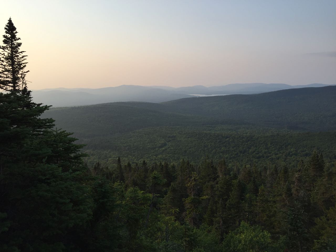
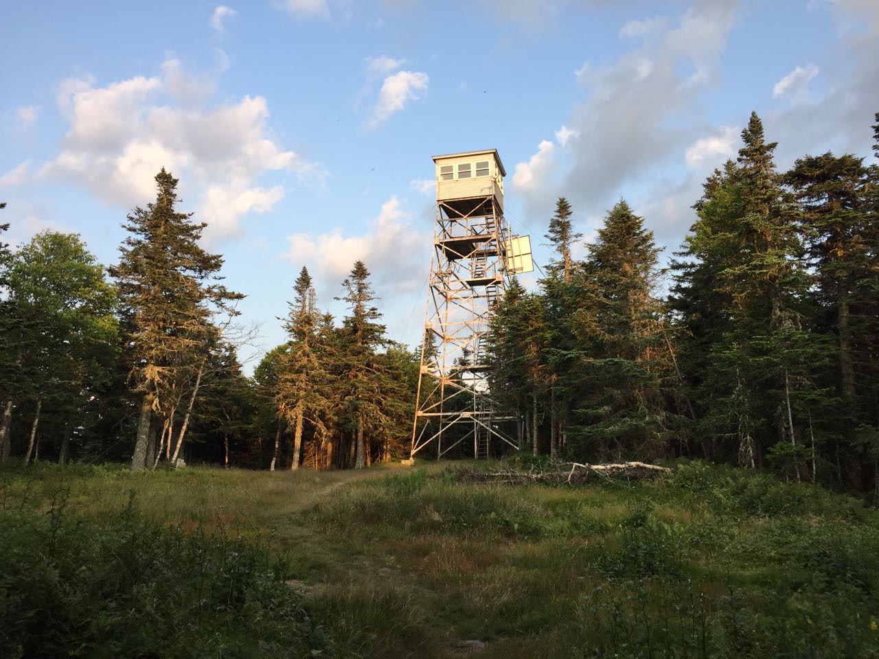
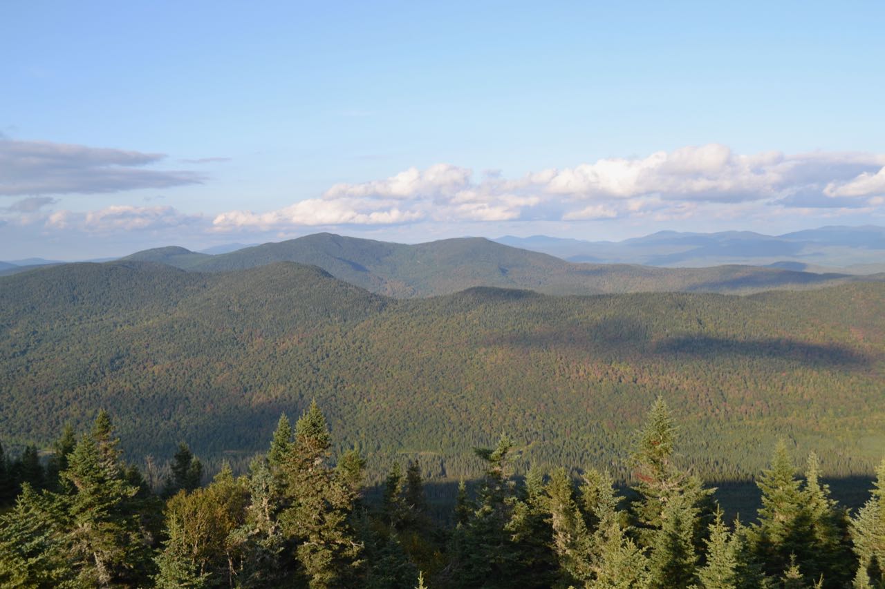
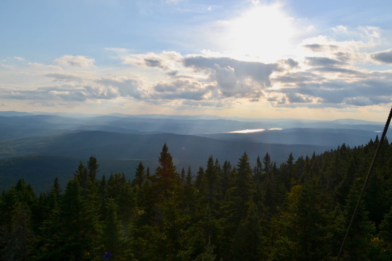
Located in a remote area of New Hampshire not known for its hiking trails, Magalloway Mountain's fire tower offers one of the few trail-accessible views of the Connecticut Lakes Region, and one of the most magnificent fire tower views in all of New Hampshire. From the parking area, walk back along the road for a short distance and turn left across a small bridge into the woods. This is the Bobcat Trail. The trail begins to ascend easily, then steepens. In 0.4 miles, it turns left to cross a flat area. It then climbs a narrow ridgecrest more steeply for 0.2 miles to reach a spur path on the left. Step out on the path a few feet to enjoy a great view of the First Connecticut Lake, the remote valley below, and the mountainside. The trail then continues steeply up for 0.1 miles and intersects the Coot Trail. Turn right as the trail flattens out and gradually climbs for 0.15 miles on a pleasant, grassy path. At the summit is a clearing with a pair of cabins and the fire tower. From the tower, a sweeping vista of the remote and wild terrain of the Great North Woods opens up before you. You can see Lake Francis and the First and Second Connecticut Lakes. To the north, you can see the long Magalloway Road winding through the vast wilderness. Past the road, nearby Diamond Ridge and more distant Stub Hill block the view further north. To the east, the view extends into Maine toward long, river-like Azicoos Lake. Far to the south, the most northern peaks of the White Mountains can be spotted in the distance.The trail to the summit follows the fire warden's jeep road.
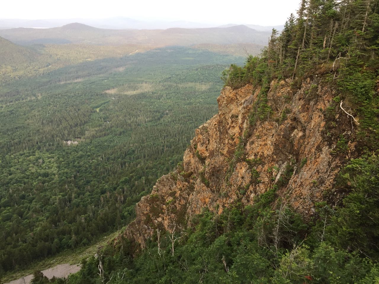
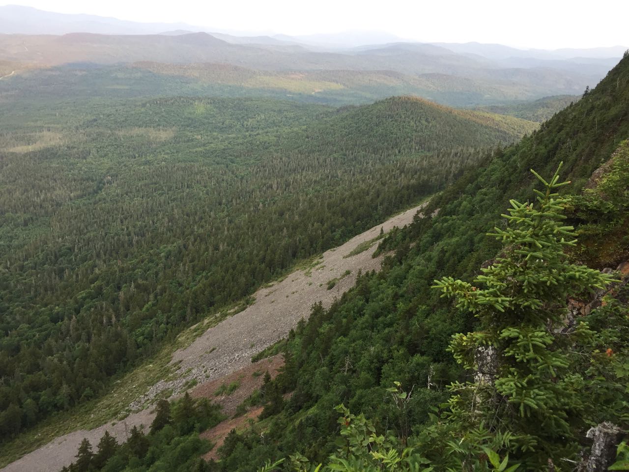
After enjoying the fantastic view from the tower, look down at the clearing below you and observe the cabin on the right (east) side of the clearing. For a quick side trip to an additional viewpoint you shouldn't miss, climb down the tower and walk over behind that cabin. Follow the unsigned path heading into the woods to the north. It runs across level ground, connecting with another path coming from the other cabin, then descends 0.1 miles to an opening with a magnificent view of a cliff on the side of Magalloway. Look down into the valley below and see the incredible sight of the extensive talus slope that sweeps across the mountainside. For an even more open view of the jumbled boulders, continue down on the path for just a short distance more. After observing this natural wonder, return to the summit and backtrack down the Coot Trail. At the junction with the Bobcat Trail, continue straight on the Coot Trail. The Coot Trail follows an old jeep road to the tower and is steep with loose rocks. Alternately, for better footing, you can also just return the way you came on the Bobcat Trail. The First Connecticut Lake is in sight over the trees again as you drop rapily on the wide path. The trail leads 0.6 miles down, moderating near the end. The trail passes a cabin and quickly ends back at the parking area.
Printable directions page