blah blah blah
East Pinnacle (Osgood Hill)
Length: 3.1 miles out-and-backDifficulty (click for info): Beginner
Elevation Gain: 460 feet (+120 feet on return)
Rating (click for info): 5/10
Elevation: 1955'
Prominence: none
Driving Directions:
Trailhead and parking area are on Stoddard Road, in Nelson, NH. To get to Stoddard Road, take Bailey Brook Road from the west side of Rt. 123 in Stoddard, 1.5 miles south of Rt. 9 and 5.5 miles north of Rt. 137. Bailey Brook Road becomes Stoddard Road at the Nelson town line. 1.4 miles in, pass the trailhead and old parking area, now barricaded and closed. At 1.7 miles from Rt. 123, turn left into an unmarked spacious grassy lot. Due to the closure, you must park here and walk back to the original starting point. Click here for a Google map.
Trail Map
About the Hike:
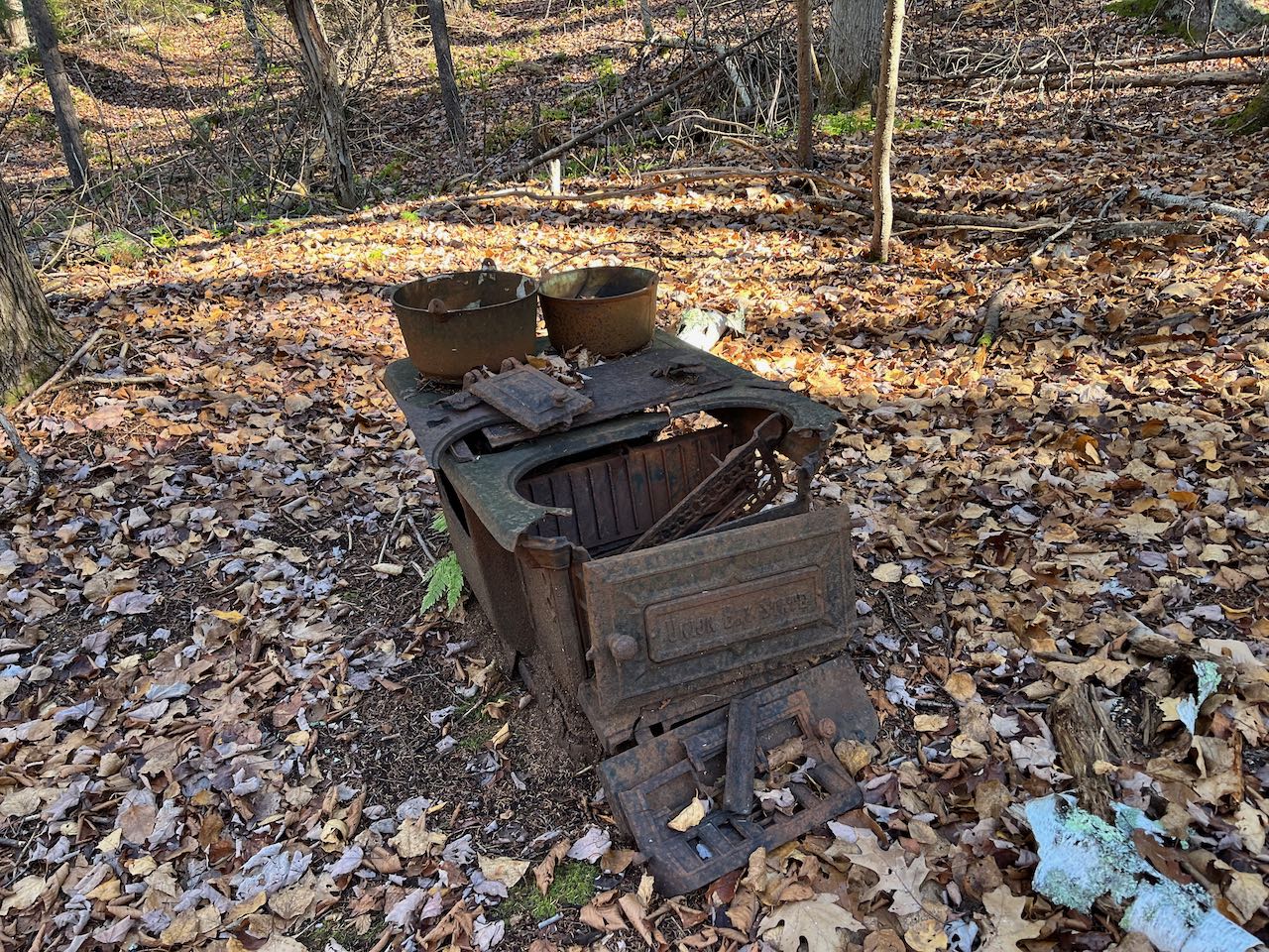
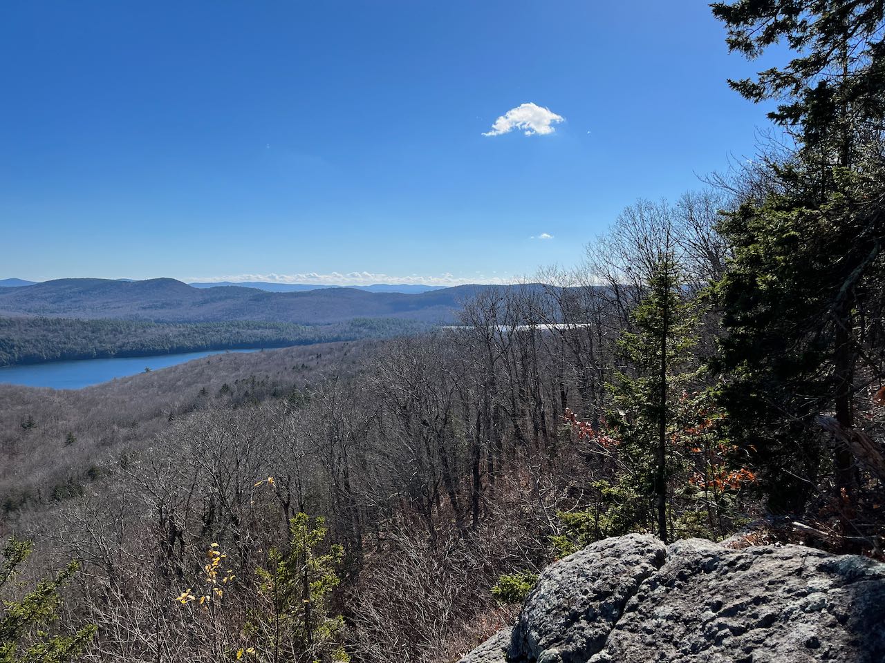
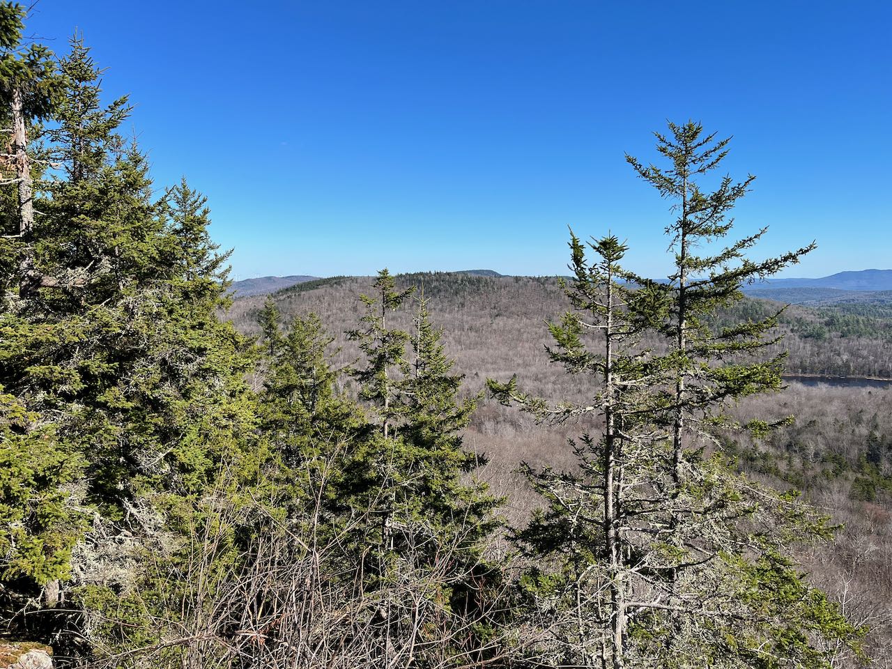
The Harris Center maintains a well-cared for network of interpretive trails and walking paths on and around the slopes of Osgood Hill, highest point in the town of Nelson. The area has some alluring history that is evident as you explore the paths' intentional routes by artifacts and remnants of the region's past. The highlight of this particular conservation property is a ledge on the side of Osgood Hill, known as the East Pinnacle. The cleared-out vista surveys a peaceful landscape of lakes and rolling hills and offers a fair amount of solitude in this especially rural group of towns. It is definitely a destination to remember for a good fall foliage trip.
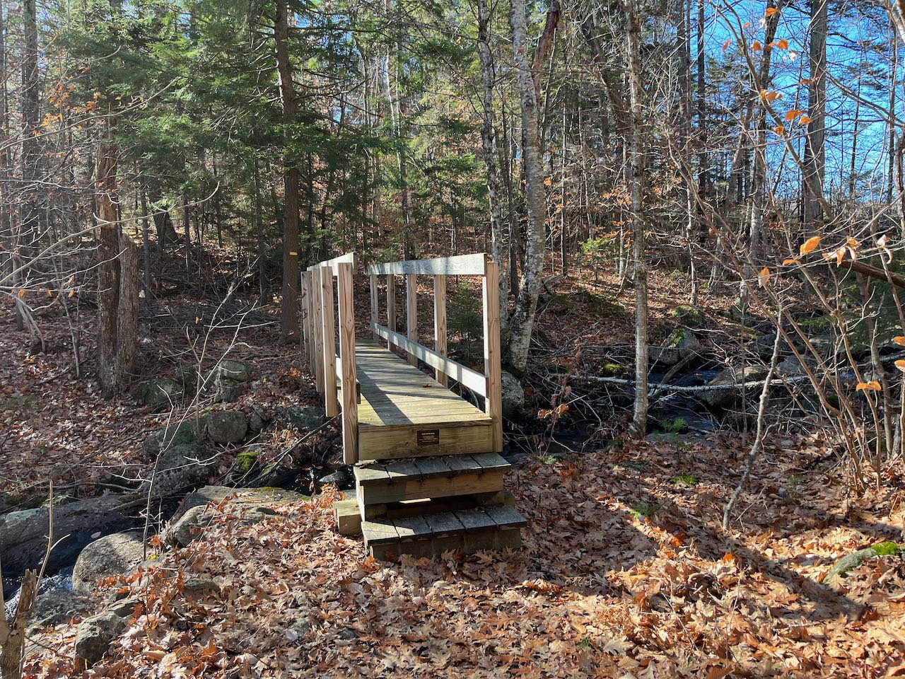
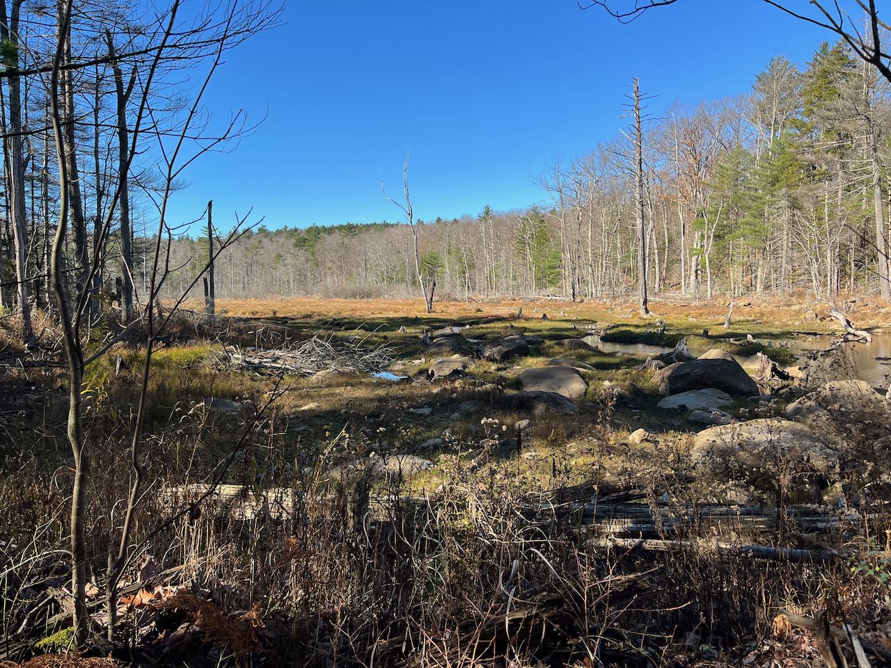
From the clearing, walk east down the road (right, facing the road) for 0.35 miles and walk into the now-abandoned former parking area. Look for the yellow sign picturing a bee. Follow the old road straight into the woods, picking up a trail guide in the mailbox if you wish (look for the one that reads "Kulish Ledge, Osgood Hill, and Holt Trail Loop"). Just over 0.1 miles in, turn right onto Kulish Ledges Trail, a narrow footpath through the woods. The trail soon crosses Bailey Brook on a sturdy wooden bridge just below its outfall from a beaver meadow. The trail leads across a few log bridges on the edge of the wetland, then arrives at a trail junction after a quarter mile. Staying on the left side of the stone wall, continue on Kulish Ledges Trail. It leads uphill very gradually, alternating sides of the stone wall. It then cuts across the rock-strewn hillside, past the "split rock" called out on the Harris Center map, to cross two channels of Bailey Brook's south branch on another pair of log bridges. This is 0.35 miles from the junction. The trail then turns uphill and passes the weathered frame of a cast iron stove and zigzags around a spruce-covered knoll. It reaches a flat section after 0.2 miles, then continues upward. Crossing a stone wall, the path circles around the hillside for another 0.2 miles to reach the clear opening on the left.
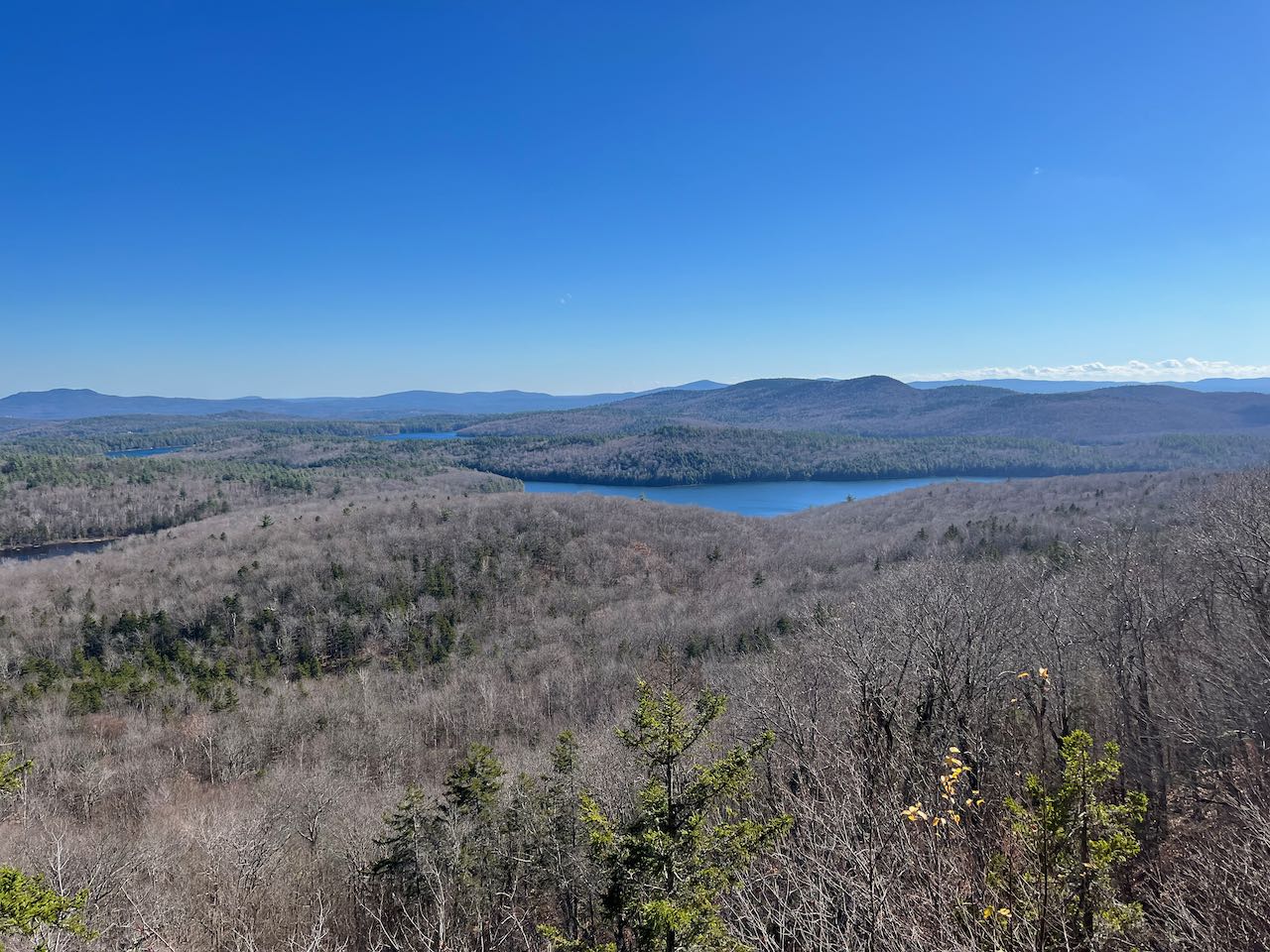
The ledge provides a tranquil view of the area's meandering waterbodies and bumpy hills. Most visible is Spoonwood Pond, with Skatutakee and Thumb Mountains behind and Cobb Hill off to the right. The tops of the Wapack Range can be seen in the distance behind. A couple sections of Nubanusit Lake can be seen to the left; you can see Rose and Winn Mountains behind the portion to the right and Crotched Mountain behind the portion to the left. All the way over to the left is nearby Holt Hill and the wind farm on Tuttle Hill. Beyond this point, the trail continues past a couple more viewpoints, but none nearly as open as East Pinnacle. Its final destination is the viewless summit of Osgood Hill, where a loop can be made if desired down the Holt Trail; consult the paper trail guide.
Printable directions page