blah blah blah
Diamond Peaks
Length: 6.7 miles out-and-backDifficulty (click for info): Moderate
Elevation Gain: 990 feet (+180 feet on return)
Rating (click for info): 9/10
Elevation: 2047'
Prominence: 669'
Driving Directions:
Trailhead and parking area are on Dead Diamond Road in Second College Grant, NH. Dead Diamond Road leaves the north side of Rt. 16 0.3 miles west of the ME/NH border. Drive 0.2 miles in the road and park at a designated parking area on the right. Click here for a Google map.
About the Hike:
Less than a mile from the Maine border rises the rugged, round ridge of the Diamond Peaks, located within Second College Grant, a township with zero permanent residents owned entirely by Dartmouth College. The college has owned and managed the township since 1807, and it is used by students for outdoor excursions as well as by the college for research and income from timber harvests. The grant contains many exceptional natural features, of which the Diamond Peaks ridge is among the most noteworthy. Although low in elevation compared to nearby mountains, the peaks boast enormous cliffs, which are astounding when seen up close. The college maintains a hiking trail that traverses the ridge and visits many spectacular viewpoints. The trail begins at the grant management center, which is essentially the "center of town" for the grant. The only way to access the interior of the grant is on the dirt Dead Diamond Road, which begins on Rt. 16 very close to the main border. It is over two miles to the management center on the road, but unfortunately for hikers, the road is gated and only college students and staff have permission to drive it. However, nothing about the extra distance is boring; as you walk the road, you will encounter a wide array of scenery and northern forest beauty.
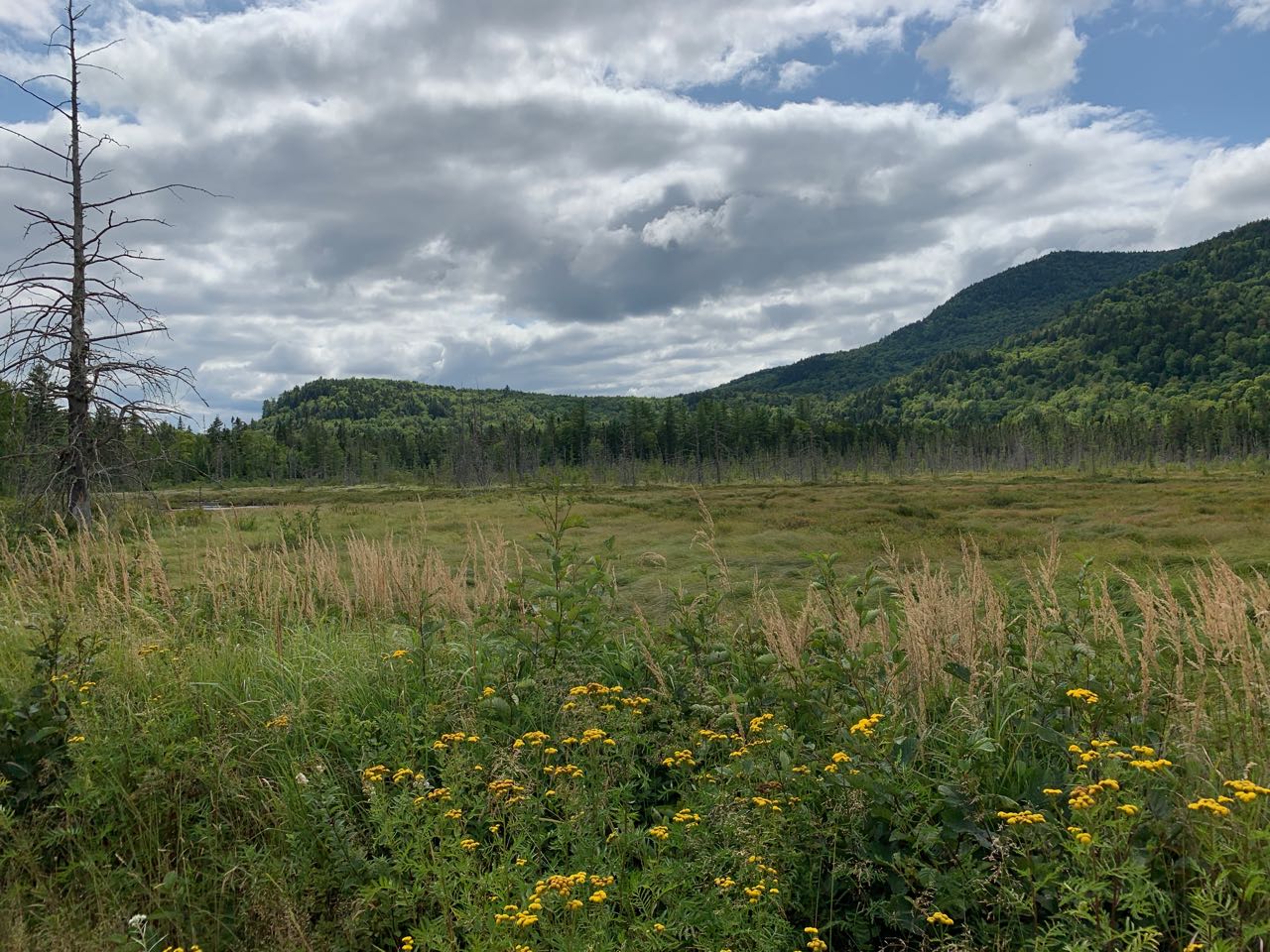
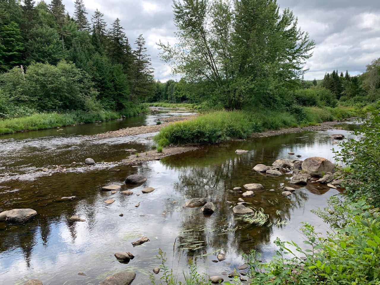
From the parking area, continue past the gate and begin walking the road. You will quickly come out to a scenic wetland area with views of Mt. Dustan's long ridges. In 0.4 miles, the road leaves the wetland area and joins the Diamond River, just through the trees to the right. It crosses an extremely flat plain as it parallels the Diamond River; you are not far from the mouth of the river at the larger Magalloway River. In another 0.4 miles, the road passes a cabin, turns right, and crosses the river on a wooden bridge, where there are scenic views upstream and downstream through a large open area. It then swings left and rises up on the very sharp slope of South Diamond Peak on the north side of a gorge in the Diamond River. There are a few spots to see the impressive rapids and cliffs down through the trees. It reaches its highest point above the gorge in 0.6 miles from the bridge, then gradually descends, passing the rock outcrop with the best view into the gorge. In another 0.5 miles, the road reaches the confluence of the Dead Diamond and Swift Diamond Rivers, a notably beautiful area where the water is shallow and clear. In 0.3 miles more, the road reaches a major intersection at the grant management center. A large road sign indicates the distances to various campsites in the Second College Grant, while a smaller sign on the lawn in front of one of the buildings on the right marks the trail to Alice Ledge, Linda Ledge, and Diamond Peaks.
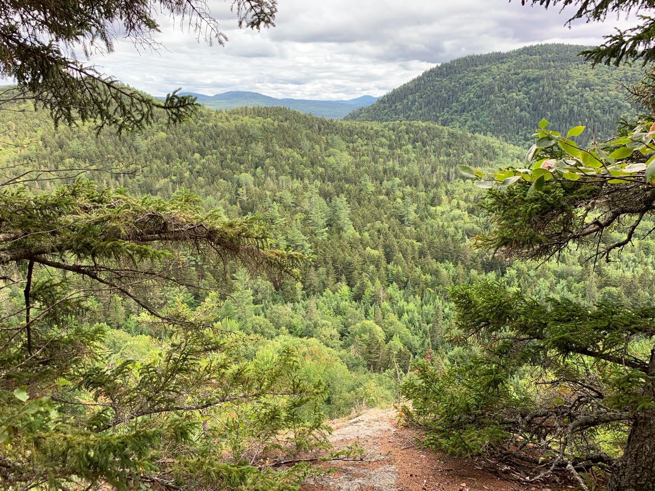
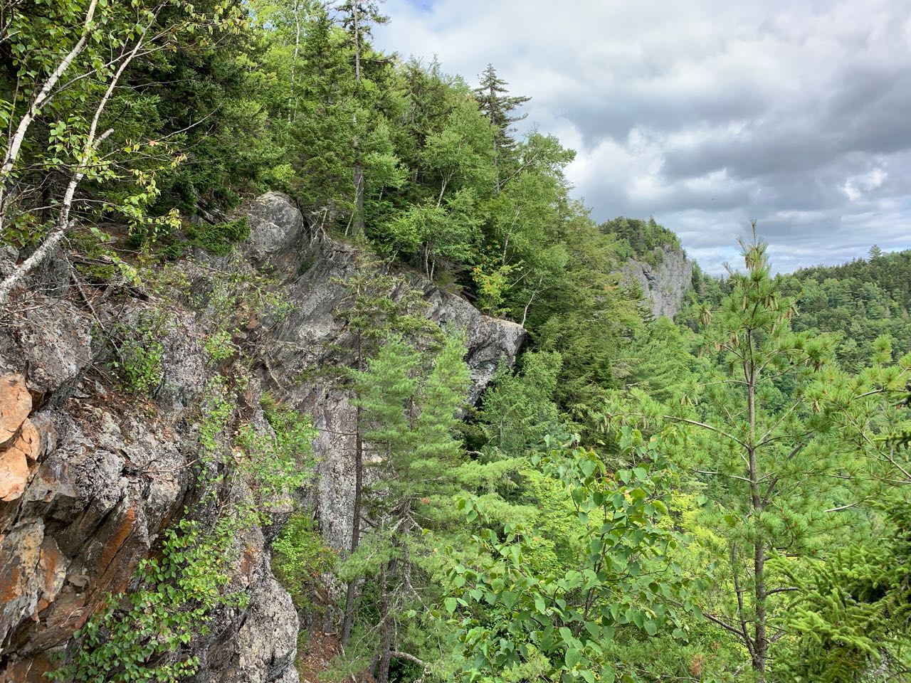
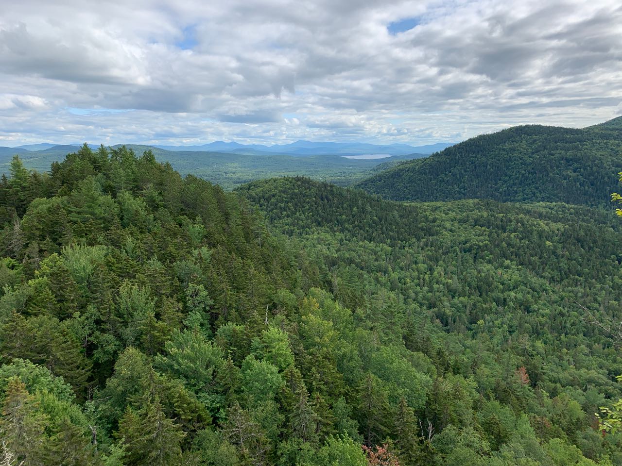
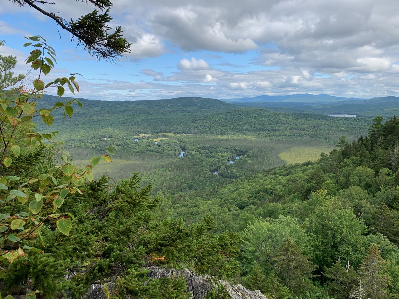
Head this trail into the forest, which is amazingly dense and dark. The trail crosses a small wet area on bog bridges, then suddenly emerges in the open forest, with a clear view of the trail ahead. It climbs a short, steep pitch to reach the ridge top in a quarter mile, where it forks at an unsigned junction. Turn left first to visit Alice Ledge. The spur path is about 0.05 miles long, and leads up to a low viewpoint over the valley you walked through on the road where the two Diamond Rivers converge. Return to the junction and continue up the main trail (the right fork from where you came up) as it climbs moderately for 0.2 miles to the first viewpoint on Linda Ledge, nearly the same as Alice Ledge but a bit higher. The trail then climbs steeply for a short distance and passes one more viewpoint before going back into the woods to cross over a small knob. It soon gets steeper and closer to the edge as you pass more fine viewpoints. Some sections of the trail here are unsettlingly close to the cliffs - use caution. The last viewpoint on the Linda Ledges offers a view of the main cliff below the summit of the Diamond Peaks, which is quite amazing from where you stand. The trail continues up through the forest, just passing by the top of West Diamond Peak 0.2 miles after the viewpoint. It then drops sharply over a slippery ledge and descends slightly for 0.1 miles to the col between the two minor summits. Just past the low point, you will see a sign marking "Diamond Back Trail", which receives almost no use. The trail climbs again for the final 0.1-mile ascent to the summit over ledges. The highpoint is just off the trail to the left before the trail drops 20 feet to a perch above one of the cliffs, where there are panoramic views. This viewpoint is quite spectacular. It is a very dramatic vista, close to the cliff's edge. You can look down on the South Diamond Peak and its long ridge down to the gorge that the road passes through. You can see Mt. Dustan on the other side as well. There is an excellent distant view, ranging from the Mahoosuc Range to Elephant Mountain, mostly taking in western Maine. There is also a great look down at the Magalloway River and a huge bog beside it.
Printable directions page