blah blah blah
Bondcliff
Length: 18.6 miles out-and-backDifficulty (click for info): Extreme
Elevation Gain: 3210 feet (+110 feet on return)
Rating (click for info): 10/10
Elevation: 4261'
Prominence: 218'
Driving Directions:
Trailhead and parking area are on the Kancamagus Highway in Lincoln, NH. Park at the very large Lincoln Woods Visitor Center parking, on the north side of the road, 5.1 miles east of Rt. 93 at exit 32. Look for the entrance immediately after crossing the bridge over the east branch of the Pemigewasset River. On busy weekends, parking spills out to the roadside along the Kancamagus Highway, in which case a connecting path can be walked from the west side of the bridge to the start of the Lincoln Woods Trail. Click here for a Google map.
About the Hike:
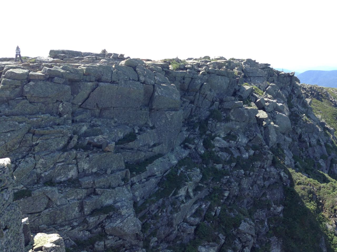
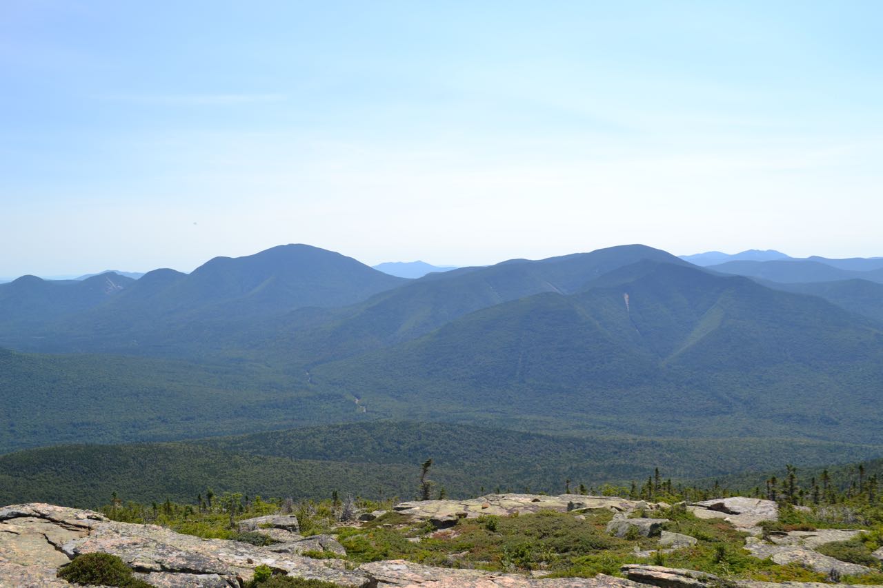
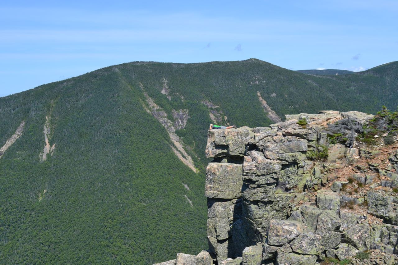
Bondcliff is a southern spur of Mt. Bond famous for its incredible cliffs, which drop hundreds of feet from the summit to the valleys below. Surrounded by these vast valleys on three sides and connected to Mt. Bond by a majestic alpine ridge, Bondcliff's view takes in the mountains around the edge of the Pemigewasset Wilderness from the inside. Hikers on its summit are rewarded with the same wonderful sense of isolation that makes Mt. Bond one of the top viewpoints in the White Mountains. Most hikers will tell you that Bondcliff (along with West Bond) is superior to Mt. Bond, because although Bond itself blocks the view to the north, Bondcliff's open summit and spectacular alpine scenery, along with its magnificent view similar to Bond's, are what distinguish it. Getting to this prize is not easy, because although the trail to it is never very steep, it is over nine miles one way. Much of this is on the old railroad grades that the Pemigewasset Wilderness is famous for, and there are many rivers and brooks to see along the way.
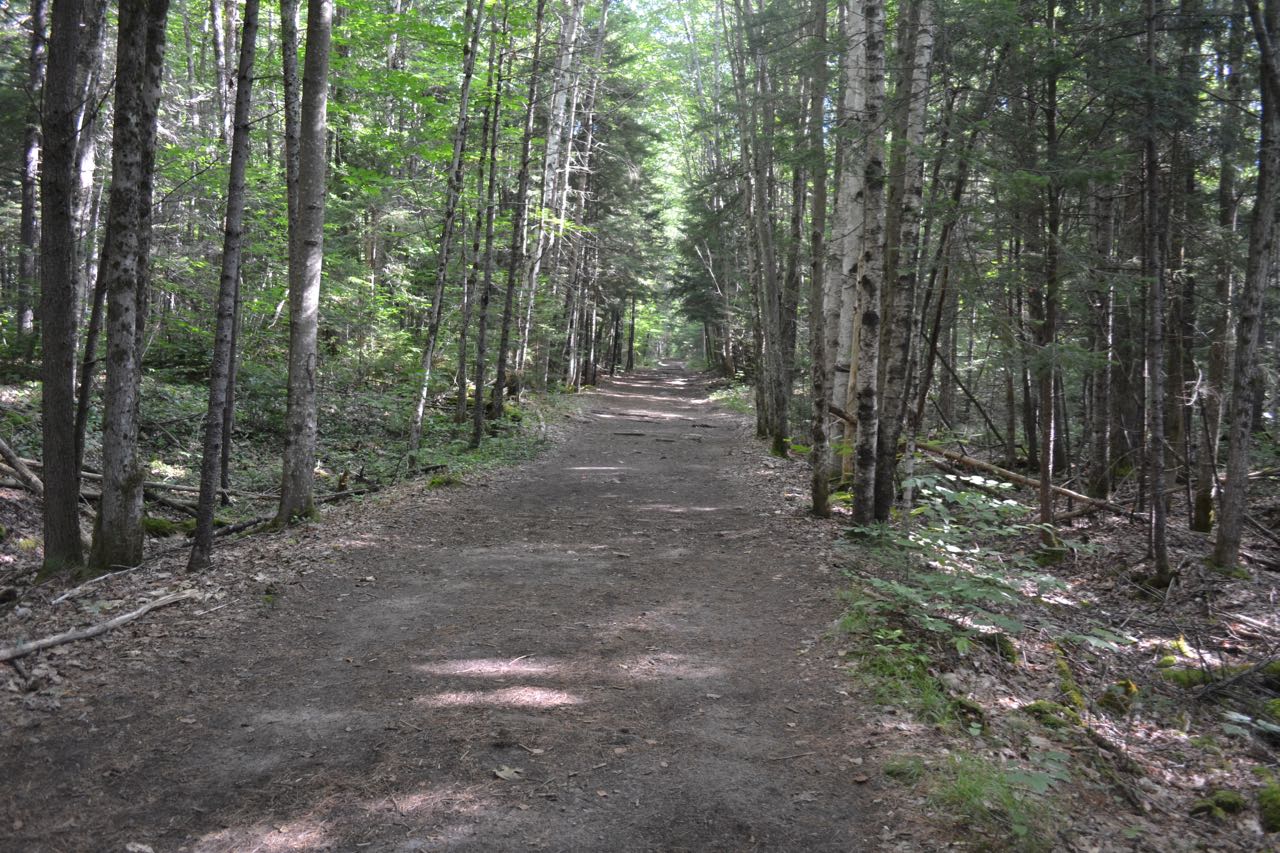
The lengthy trek begins at the Lincoln Woods parking area. Walk to the end of the parking area and onto the deck of the visitor center. Turn left at the trail signs and walk down the stairs onto a gravel connecting path. Turn left, then right and cross the iconic suspension bridge over the East Branch of the Pemigewasset River, a much larger and wilder waterway than the "main" branch of the Pemigewasset River. On the other side, turn right and follow the very wide and flat Lincoln Woods Trail as it follows the East Branch on the bed of an old logging railroad, last operated in 1948. The first mile is mostly over graded surface, but soon after, the pathway becomes studded with railroad ties. At 0.7 miles, the trail goes along a fence atop a washed-out bank, which provides a nice spot to look out over the river. Just beyond, the trail passes over Osseo Brook as it drains into the East Branch and proceeds to parallel it. The trail continues next to Osseo Brook for 0.6 miles before the brook diverges to the left, followed by the Osseo Trail. At this junction is an informative sign about logging artifacts which may be found in the forest. Just after this, the trail passes a clearing from a logging camp on the left. In another 0.2 miles, the trail reaches its second viewpoint over the river, next to a long piece of rail. Bondcliff's south spur rises prominently above the river, with the summit of Bondcliff to its left. The trail then crosses Birch Island Brook on a bridge and continues very straight for 0.9 miles. After this section, Black Pond Trail goes left. A short distance past this, two signs mark a 200-foot interval where hikers are given the opportunity to measure their stride. Franconia Falls Trail goes left soon after (0.3 miles since Black Pond Trail), and Lincoln Woods Trail crosses a bridge over Franconia Brook built around the remains of a railroad trestle, enters the Pemigewasset Wilderness, and dead-ends at a fork.
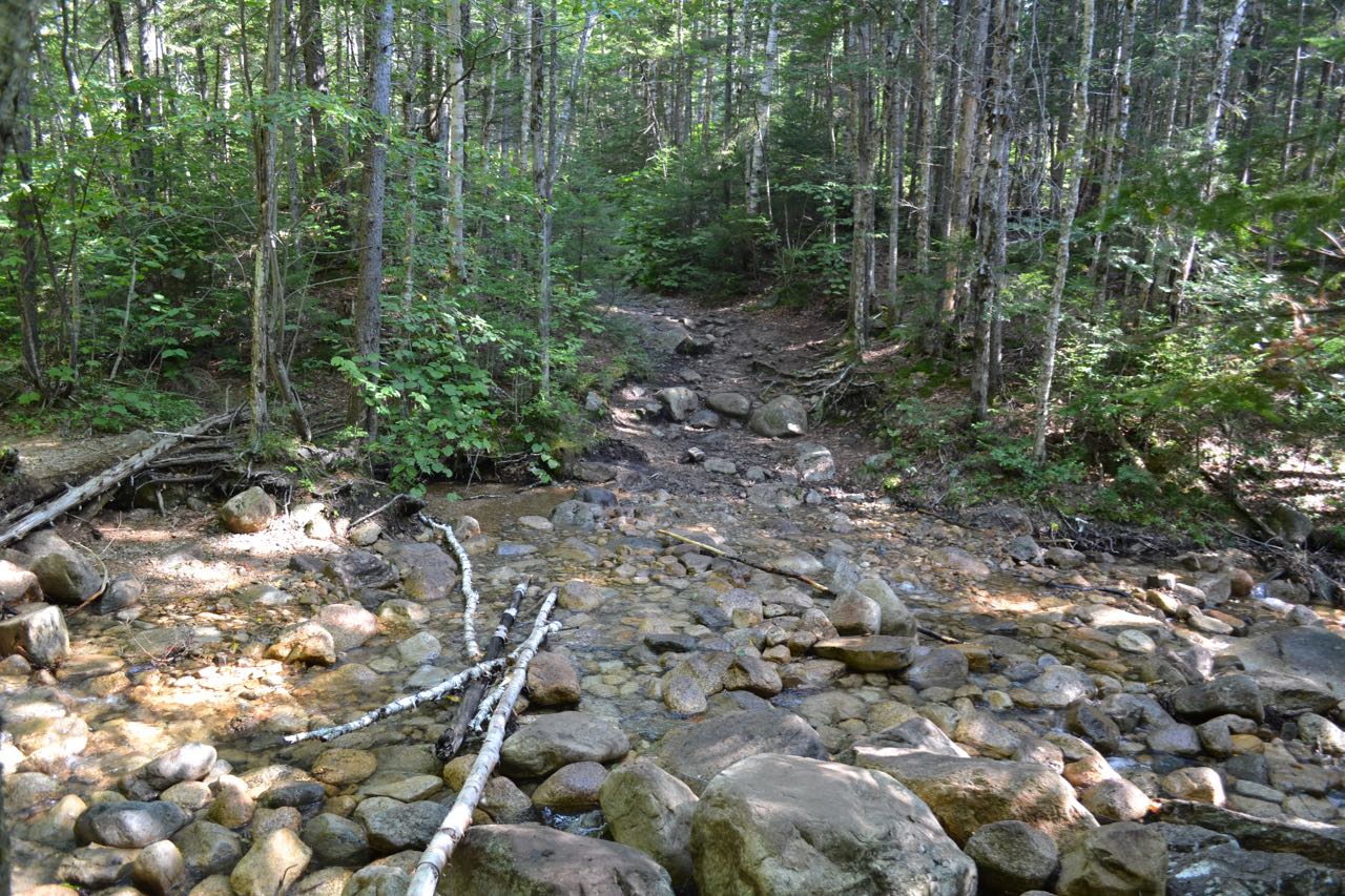
Here, Franoncia Brook Trail forks left, while Bondcliff Trail goes right. Bear right onto Bondcliff Trail (this section was formerly part of Wilderness Trail) and follow it as it leads around a muddy section, then joins a railroad grade again. Another 1.8 miles of flat, easy walking lies ahead. Here, too, there are many railroad ties across the path. About halfway through this section, the trail briefly nears the East Branch and crosses a brook, then passes a logging camp clearing. At the end of this section, reach the former Bondcliff Trail junction. To take a short and worthwhile detour, continue straight onto the muddy railroad grade, now a closed section of Wilderness Trail, and walk less than 0.1 miles to a dilapidated old railroad trestle over Black Brook, an interesting sight in the middle of a wilderness. Back at the junction, continue on Bondcliff Trail, which now begins climbing. It meanders through the woods, ascending gradually and crossing a small stream before leveling out and making a minor descent to Black Brook in 1.1 miles. The trail follows the brook (out of sight) for the next 0.3 miles, then turns right and crosses it. This crossing is on small stones and may be difficult if water is high. The trail continues ascending gradually parallel to the brook, and crosses it again in a half mile. After this crossing, the trail climbs a little more steeply above the brook, but still parallels it. In 0.6 miles, the trail crosses the brook a third time. At this spot, the brook is much rockier and may be dry in the summer months. On the other side, the trail turns right, heads downhill a short distance along another usually dry brook, then makes a 180-degree turn to the left, back uphill. It then makes the steepest climb of the hike, ascending on three long strings of stone stairs. At the top, it swings to the left and leads across the ridge top to the other side of the ridge, then swings back to the right and heads across the slope. It soon passes an open area where you can look up to the summit. Just past this, the trail descends a short distance to the final crossing of Black Brook, then turns left and angles up the rocky slope of the ridge on the other side. It makes several winding, twisting switchbacks to get higher up, then turns left again and continues angling uphill, about 0.4 miles from the brook. The trail remains very rocky as it climbs. In half a mile, it turns to the right and climbs more steeply, then in 0.4 miles, it turns to the right again. It becomes less rocky as it climbs along a moss-lined path, soon becomes steeper, then in 0.2 miles, makes a rock scramble and soon emerges in the alpine zone. It heads up in the open, with spectacular views, to the flat summit rock, with the iconic cliff ahead.
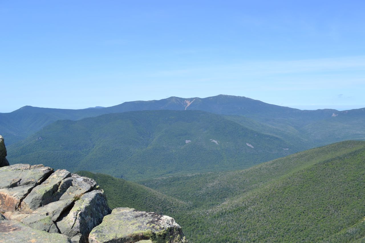
Straight ahead, to the north, an alpine ridge leads up to Mt. Bond. West Bond, marked with many slides on its steep south slopes, is seen to the left of Bond. South Twin Mountain peeks out from between the two. To the northwest is pyramidal Mt. Garfield. To the west, you look over the Franconia Brook valley to ridge-like Owl's Head Mountain and the lofty Franconia Ridge beyond. To the southwest are the southern peaks of the Franconia Range, Mts. Flume and Liberty. Mt. Moosilauke is in the distance behind. To the south, you can see into the distance over Loon Mountain and its ski area. To the left of Loon are the many peaks of Scar Ridge, followed by Mt. Osceola. Mt. Tecumseh is seen behind Osceola to the right and Sandwich Dome is behind to the left. Mt. Hitchcock is in front of Mt. Osceola. Next over, you see over a ridge of Mt. Hancock to Mts. Huntington and Kancamagus, and in the distance, the Tripyramids and Mt. Passaconaway. To the southeast are the massive Mts. Carrigain (L) and Hancock (R), especially impressive from here. Mt. Chocorua appears between the two. To the left of Carrigain is the Nancy Range, with the steep slides on Mt. Lowell across Carrigain Notch from Vose Spur. Moat Mountain is behind. To the left of Lowell are Anderson, Nancy, then Bemis. Kearsarge North and surrounding hills are seen to the east, beside the lower Montalban Ridge: Mt. Resolution and Stairs Mountain. Further to the left is the distant Baldface Range. The ridge continues up over Boott Spur to Mt. Washington. Mt. Clay is next to the left, just to the right of the slope of Mt. Bond, which hides the other Northern Presidentials. Nearby Mts. Field and Willey are seen below Mt. Washington.
Printable directions page